As global sea surface temperatures rise, are hurricanes becoming more powerful? The relationship between climate change and hurricane intensity is a consequential and genuinely difficult question, and the honest answer is nuanced: some trends are now well established in the data, while others remain areas of active research and debate.
Framing the Question
Frequency, intensity, size, rainfall and movement are different properties of tropical cyclones. Evidence and projections differ for each, so a finding about one should not be generalized to all of them.
One point is worth making early. The public conversation fixates on whether storms are becoming windier, which is the hardest signal of all to isolate. The clearer changes, and arguably the more consequential ones for damage, are in rainfall and in storm surge riding on higher seas. Understanding what has already changed requires accounting for several complicating factors: measurement bias over time, natural variability from ocean cycles, and the inherent difficulty of separating human-caused climate signals from background noise.
Why Warmer Water Matters
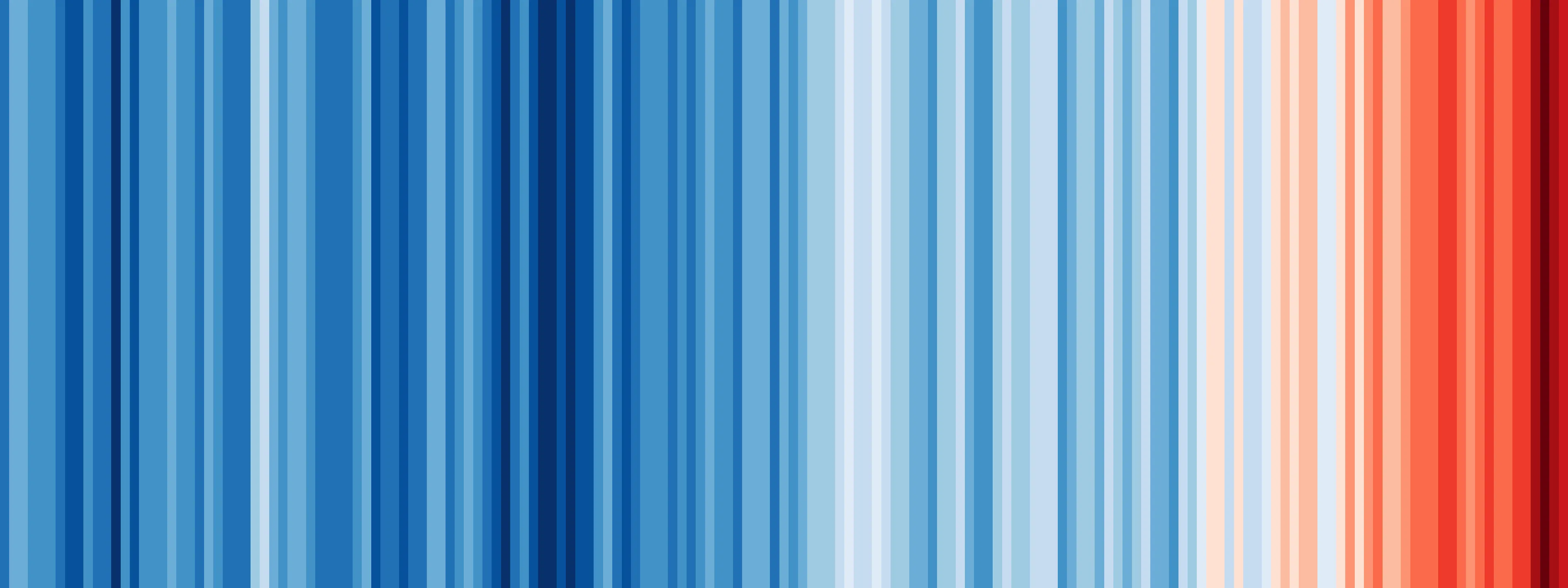
The fundamental physics is well understood. Hurricanes extract energy from warm ocean water, much like a heat engine. The warmth of the sea surface temperature (SST) is one of the primary thermodynamic constraints on how intense a hurricane can become, a limit called the potential intensity. This relationship is grounded in the Clausius-Clapeyron equation, which describes how atmospheric moisture content increases with temperature. For every 1 degree Celsius of warming, the atmosphere's saturation vapor pressure increases by approximately 7 percent.1
Potential intensity depends on the ocean–atmosphere energy imbalance and the thermodynamic efficiency of the storm, including the temperature of its upper-level outflow. Sea-surface temperature alone is insufficient: warming of the atmosphere also matters. The cited 2005 book explains this theory.2
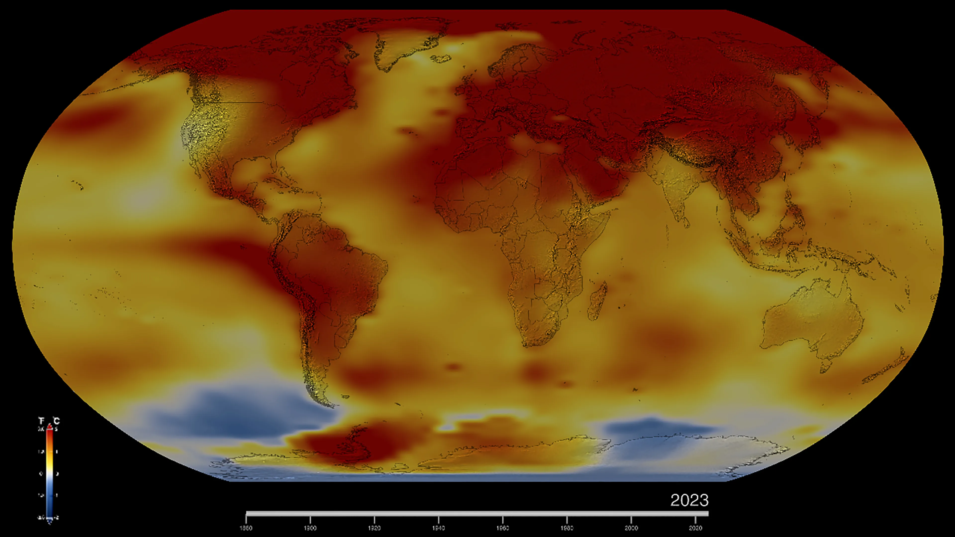
Potential intensity is a theoretical bound under specified oceanic and atmospheric conditions. Actual intensity also depends on organization, shear, moisture, ocean cooling and time available to strengthen.3
The Observational Challenge
Routine satellite coverage improved basin-wide detection in the 1960s, but it did not create a uniform record of direct wind measurements. Satellite intensity estimates depend on sensors and analysis methods; modern studies homogenize the record to reduce these differences.4
HURDAT2: the historical record
The most comprehensive Atlantic hurricane dataset is HURDAT2, maintained by NOAA's National Hurricane Center. Historical records before the satellite era (pre-1966) relied on ship reports, coastal observations, and barometric pressure readings. These early records have systematic biases: weaker storms were underreported, landfalling storms over sparsely populated regions were missed, and measurement techniques improved significantly over the 20th century. Any trend analysis must account for these detection biases.
What satellite-era trends show
Kossin and colleagues studied a homogenized global satellite record for 1979–2017. They found an increase in the probability of hurricanes exceeding major-hurricane intensity. This is not a study of an unchanging 1966-to-present Atlantic Category 4–5 record.4
The 2020 paper concerns major-hurricane exceedance probability. Rapid-intensification trends and poleward migration of peak intensity are distinct questions addressed by other studies; they should not be attributed to that paper’s result.4
Detection bias and its implications
Changing observations affect storm counts and intensity estimates in different ways. Detecting additional weak storms can lower the apparent fraction of strong storms, while better measurement of peak winds can alter intensity classifications. There is no single direction of bias applicable to every statistic.3
The Bias Problem: It is fundamentally difficult to know whether an increase in Category 4–5 hurricanes reflects true intensification or better detection. Researchers attempt to correct for this using homogenization techniques, but these are imperfect and model-dependent.
Rapid Intensification: A Clearer Signal
One of the most robust observational findings involves rapid intensification (RI), a hurricane strengthening by at least 35 mph (55 km/h; 30 kt) in 24 hours. Rapid intensification events are sudden, dramatic, and pose major challenges for forecasting and coastal preparation.
The IPCC assesses that the global frequency of rapid-intensification events has likely increased over the past four decades. The size and attribution of changes depend on the period and basin. This does not establish that rapid intensification is the primary effect of warming rather than changes in peak intensity.1
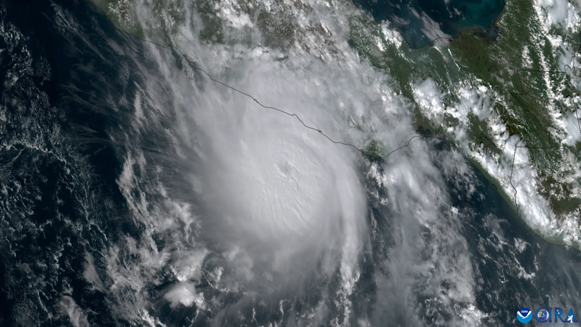
The mechanism is plausible: in a warmer ocean, storms encounter a higher heat flux, allowing for faster intensification. Additionally, reduced wind shear (a difference in wind speed and direction with altitude) in certain warming scenarios can also promote rapid intensification. These are mechanistic explanations grounded in hurricane physics.
How Sea Level Rise Compounds Storm Surge
Higher relative sea level raises the baseline for coastal flooding. Surge dynamics can also change with water depth and coastal geometry, but reduced friction is not the sole explanation. The amount of added inundation requires a local assessment.
NOAA’s 2022 U.S. interagency report projects an average 10–12 inches (0.25–0.30 m) of additional relative sea-level rise along the U.S. coastline between 2020 and 2050, with regional differences. That projection is not a uniform global rise measured from today.5
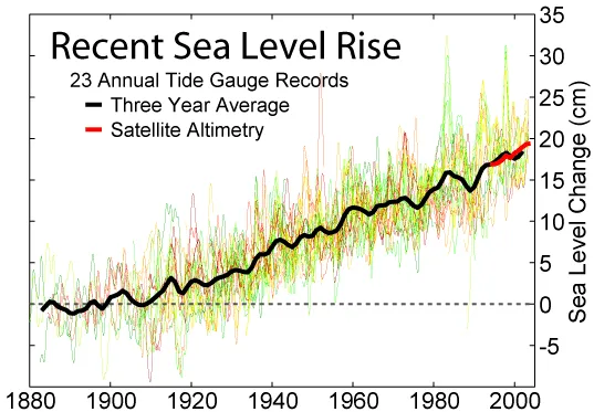
This compounding effect has received less public attention than intensity changes, but it may ultimately be more consequential for coastal risk, particularly for low-lying areas and island nations. The mechanics of storm surge explain why even a small rise in the baseline matters so much.
Rainfall: The Clearest Signal
One area carries less uncertainty: the relationship between warming and rainfall. The Clausius-Clapeyron relationship implies that storms in a warmer atmosphere will contain more moisture. Multiple studies have documented that precipitation rates in tropical cyclones have increased in recent decades, with expected increases of 3–10 percent per degree Celsius of warming.1
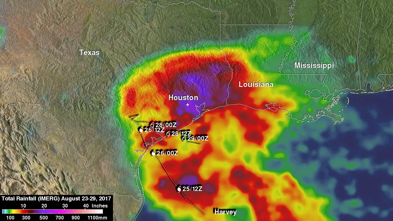
GFDL’s synthesis reports a median projected increase of roughly 14% in tropical-cyclone rainfall rates within about 100 km of the center for 2°C of global warming, with substantial variation among studies. This is a global projection under a specified warming level, not a forecast of rainfall in every future hurricane.3
Rainfall and coastal flooding both deserve attention. Their relative mortality burden depends on the period, geography and inclusion of indirect deaths; this article does not establish a timeless ranking.
What Remains Uncertain
The scientific consensus has solid ground beneath it on mechanisms and some observed trends, but significant uncertainties persist.
Frequency, or the lack of a clear trend
The IPCC projects that global tropical-cyclone frequency will decrease or remain unchanged, while the proportion of very intense storms increases. Observed long-term frequency trends remain difficult to establish, and regional changes need not match the global result.1
The attribution challenge
Attribution compares observed changes with what would be expected under different forcings, using physical understanding, observations and models. A detected trend and an attributed human contribution are related but distinct findings.1
Natural variability: the AMO and ENSO
Atlantic multidecadal variability involves internal variability and external forcing, including aerosols and greenhouse gases. Treating it as a regular 60–80-year natural clock is misleading. ENSO also changes the environment from year to year.3
Model uncertainty and grid resolution
Projected intensity changes depend on the warming scenario, basin, metric and model. GFDL’s synthesis gives a global mean intensity increase of roughly 4% for 2°C warming, with a range across studies. Comparisons require the same metric and warming scenario.3
Model resolution affects how well a simulation represents an eyewall and its peak winds. Coarse grids can smooth these features, contributing to differences between intensity projections. Resolution is one of several modeling choices that should be considered when comparing studies.
The IPCC AR6 Assessment
The Sixth Assessment Report of the Intergovernmental Panel on Climate Change (IPCC AR6, 2021) provides the most authoritative synthesis. Key findings from Working Group I, Chapter 11, include:
- The global proportion of major (Category 3–5) tropical cyclones likely increased over the past four decades.
- With warming, the proportion of Category 4–5 storms and tropical-cyclone rainfall rates are projected to increase.
- Global tropical-cyclone frequency is projected to decrease or remain unchanged.
- Regional changes and individual-event attribution require more specific evidence.1
Confidence Levels Matter: "Likely" in IPCC terminology means 66–100 percent probability; "very likely" means 90–100 percent. These likelihood ranges differ from the IPCC’s separate confidence assessments, which consider evidence and agreement. The use of probabilistic language acknowledges genuine scientific uncertainty.
What Does This Mean for Preparedness and Planning?
From a practical standpoint, several implications emerge:
- Intensity matters for wind damage: a 10–20 percent increase in the proportion of the strongest storms translates to meaningfully more damage from winds, even if the overall frequency stays constant.
- Rainfall flooding is increasingly critical: hurricane-driven rainfall is now the leading precipitation hazard, and climate change is making this worse, independent of intensity.
- Storm surge is compounded by sea level rise: for coastal planning, the combination of intensity, rapid intensification, rainfall, and rising sea levels creates a multi-factor risk that is substantially higher than any single factor alone.
- Uncertainty cuts both ways: climate models project more intense storms, but the magnitude is uncertain. This does not justify inaction; it justifies prudent planning that accounts for a range of possibilities.
A Note on Individual Events
Attribution studies ask how human influence changed the likelihood or severity of a specified event characteristic. Do not assume that every hurricane or every aspect of one became worse; an event-specific claim needs an appropriate study.
This distinction may seem semantic, but it is crucial for understanding attribution. A hurricane is not "caused" by climate change the way a car accident might be caused by a drunk driver. Rather, climate change loads the dice, making stronger storms and wetter storms statistically more likely.
Sources
-
Seneviratne, S. I., et al. (2021). Weather and climate extreme events in a changing climate. In Climate Change 2021: The Physical Science Basis (Working Group I, IPCC Sixth Assessment Report), Ch. 11. Cambridge University Press. https://www.ipcc.ch/report/ar6/wg1/ ↩ ↩2 ↩3 ↩4 ↩5 ↩6
-
Emanuel, K. (2005). Divine Wind: The History and Science of Hurricanes. Oxford University Press. https://doi.org/10.1093/oso/9780195149418.001.0001 ↩
-
NOAA GFDL. Global Warming and Hurricanes. https://www.gfdl.noaa.gov/global-warming-and-hurricanes/ ↩ ↩2 ↩3 ↩4 ↩5
-
Kossin, J. P., Knapp, K. R., Olander, T. L., & Velden, C. S. (2020). Global increase in major tropical cyclone exceedance probability over the past four decades. Proceedings of the National Academy of Sciences, 117(22), 11975–11980. https://doi.org/10.1073/pnas.1920849117 ↩ ↩2 ↩3
-
NOAA. 2022 Sea Level Rise Technical Report. https://oceanservice.noaa.gov/hazards/sealevelrise/sealevelrise-tech-report.html ↩