These four storms caused severe harm and changed how communities approached warnings, construction and recovery. Improvements can reduce risk; they do not make a modern hurricane inherently harmless.
The Great Galveston Hurricane (1900)
On September 8, 1900, a huge hurricane slammed into Galveston, Texas. Back then Galveston was an important port city with about 38,000 people, a rich, busy port built on a low sandy island in the Gulf of Mexico. It sat only a few feet above the sea, and the city was highly exposed to coastal flooding.
The storm hit as an estimated Category 4, with winds around 145 mph (233 km/h). But the wind wasn't the worst part. The hurricane shoved a wall of ocean water, a storm surge, right over the island. That surge reached about 15 feet (4.6 m) high. Since Galveston's highest point was barely 9 feet (2.7 m) above the sea, the whole island went underwater.
The destruction was nearly total. Entire neighborhoods were swept away. Galveston remains one of the most important storms in American history, the disaster that pushed the whole country to start taking hurricanes seriously. The hardest part is that almost no one saw it coming.
The Weather Bureau issued storm warnings in 1900, but observations, forecasts and communication were limited. Officials and residents did not receive an adequate picture of the Galveston disaster that was coming. It is wrong to say no warning system existed.
Galveston built a seawall about 17 feet high and raised much of the developed city, with the greatest raising near the coast. It did not raise the entire island uniformly. These works reduced risk but could not prevent all later flooding.
Hurricane Katrina (2005)
Hurricane Katrina is one of the most well-known hurricanes in American history. It formed over the Atlantic in late August 2005 and grew fast. Over the warm Gulf of Mexico, Katrina reached Category 5 with winds of 175 mph (280 km/h). By the time it made landfall near Buras, Louisiana, on August 29, 2005, it had eased to a Category 3 with winds around 125 mph (201 km/h).1 It was still an enormous storm.
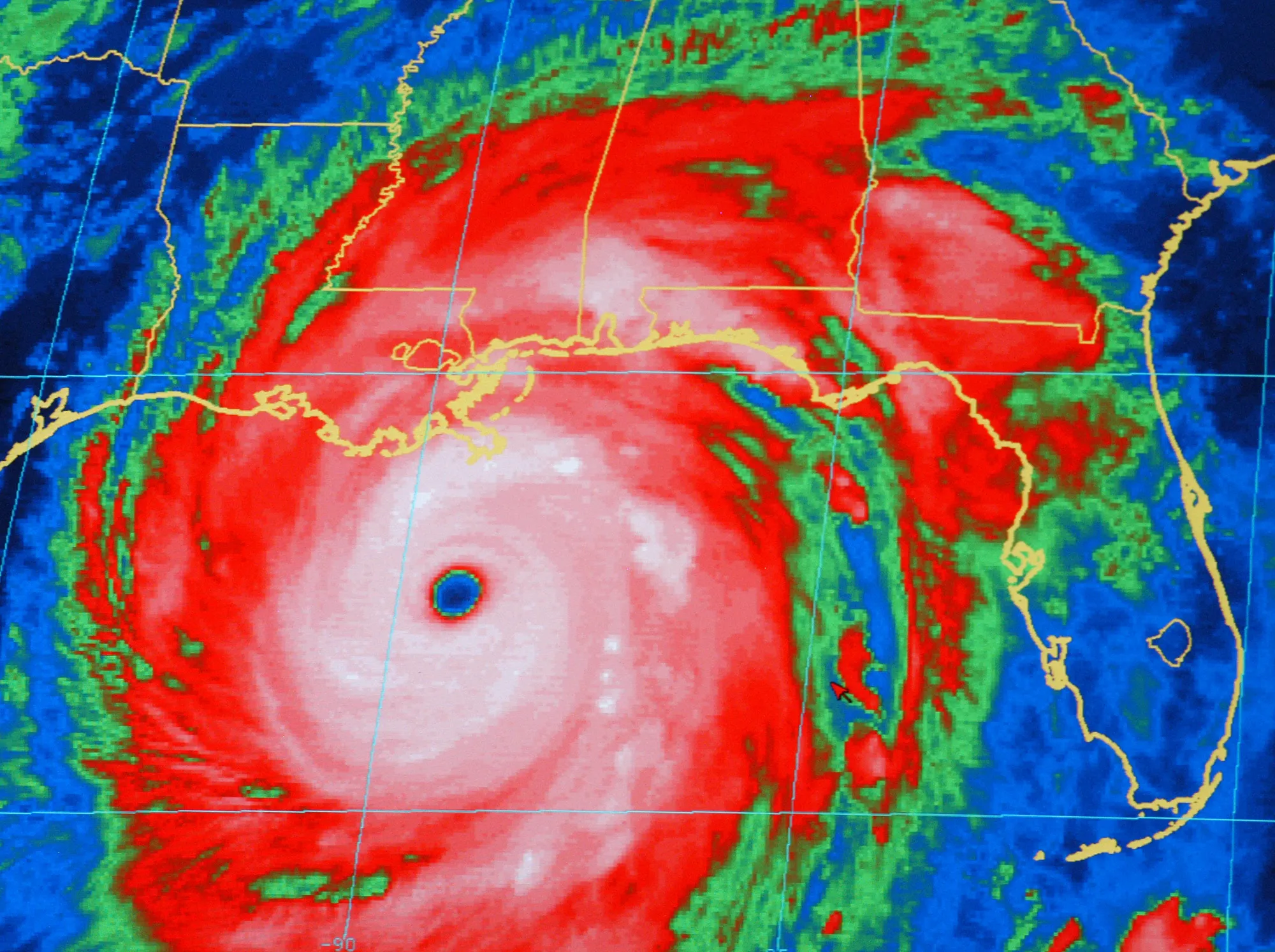
Surge devastated parts of the Mississippi coast, and failures in New Orleans’s flood-protection system allowed water to inundate about 80% of the city. NHC estimates Katrina’s U.S. damage at $125 billion in 2005 dollars. This event-year figure should not be mixed with differently adjusted estimates.2
Katrina taught the country some hard lessons. The government's response was widely criticized as too slow. Afterward, the Federal Emergency Management Agency (FEMA) was reorganized to move faster, New Orleans built a far stronger levee system costing about $14 billion, and towns everywhere took a serious look at their own evacuation plans.
Hurricane Maria (2017)
On September 20, 2017, Hurricane Maria hit Puerto Rico as a Category 4 with winds of 155 mph (250 km/h). Just before that, Maria had reached Category 5 strength with winds of 175 mph (280 km/h) and had already torn through the island of Dominica and the U.S. Virgin Islands.3
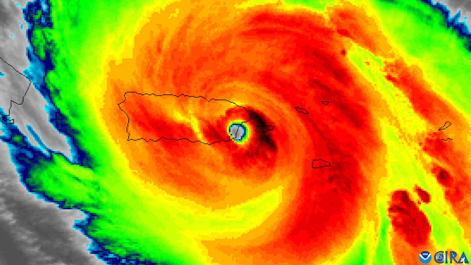
Here's something worth knowing: Puerto Rico is a U.S. territory. People born in Puerto Rico are U.S. citizens, and disaster response involved territorial, local and federal authorities.
Maria caused an island-wide power outage in Puerto Rico, with restoration taking months in many places. NHC estimates $90 billion in damage in Puerto Rico and the U.S. Virgin Islands, in 2017 dollars. Long outages disrupted health care, communications and daily life.3
There's an important, honest part to Maria's story. At first, people thought the worst was over once the wind stopped. It wasn't. The hardest stretch came in the long, dark months afterward, when hospitals had no power and roads were still blocked, and the true scale of the damage turned out to be far bigger than anyone first realized. A later study for the government of Puerto Rico, carried out by George Washington University, showed just how much harm those slow months caused. That's why we measure a storm's full impact carefully and honestly, even when the truth is hard.
Hurricane Harvey (2017)
Just weeks before Maria, another historic storm struck the United States. Hurricane Harvey made landfall on August 25, 2017, at San Jose Island, Texas, as a Category 4 with winds of 130 mph (209 km/h). Harvey had powerful wind, but that's not what made it historic. It was the rain.
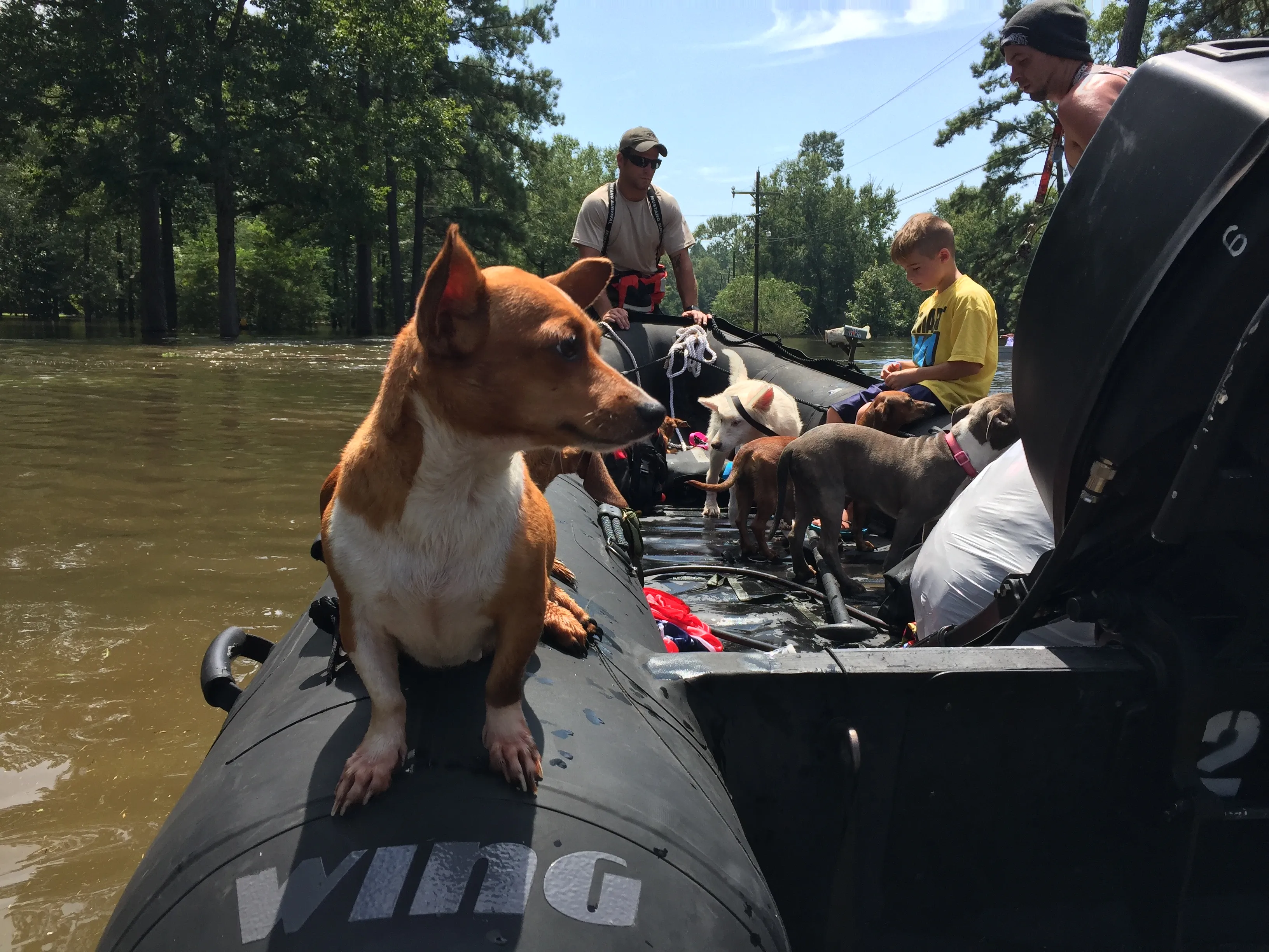
After landfall, Harvey did something unusual. Most hurricanes move inland and weaken. Harvey stalled and sat over the Houston area for days, from August 25 through August 30, dumping rain the whole time. The peak fell at Nederland, Texas: an astonishing 60.58 inches (1,539 mm). That set a U.S. record for rainfall from a single tropical storm.4
The Nederland total was measured at one location, not uniformly over an entire city. It is just over five feet of rainfall accumulated during the storm, not the depth of floodwater everywhere. NHC estimates Harvey’s total U.S. damage at $125 billion in 2017 dollars.4
Harvey taught a lesson worth remembering. A lot of people watch only the wind speed and the category number when a hurricane is coming. Harvey showed that a slow storm dropping enormous rain can be every bit as dangerous as the strongest wind, sometimes more.
How Warnings Have Gotten Better
One of the most hopeful parts of hurricane history is how much better we've gotten at spotting storms and warning people. The progress over the last 125 years is remarkable.
Galveston’s warning failures involved limited observations and interpretation as well as communication. Aircraft, radar and weather satellites were not yet available.
The Birth of Hurricane Hunting
In 1943, during World War II, Lieutenant Colonel Joseph Duckworth became the first person to fly a plane into a hurricane on purpose, in a small single-engine AT-6 Texan trainer near Galveston, Texas. By 1944, organized Air Force reconnaissance missions had begun. These crews, the Hurricane Hunters, fly straight into storms to measure wind, pressure, and other key data. By the 1950s, regular tracking flights were a big part of forecasting.
Satellites Change Everything
TIROS-1 launched on April 1, 1960. Weather satellites greatly improved ocean monitoring, but no observing system guarantees perfect detection or a correct forecast.
Better Communication
In the 1970s, the Saffir-Simpson scale gave everyone a simple way to describe a hurricane's strength, from Category 1 (weakest) to Category 5 (strongest). That made it much easier for officials and families to understand a threat and act on it.
Modern Forecasting
NHC provides tropical-cyclone track and intensity forecasts through five days. Long-term forecast improvements depend on the measure and period being compared; they do not guarantee an accurate landfall prediction for an individual storm.
That gain comes from many tools working together: satellites watching from space, radar showing the rain, Hurricane Hunter planes flying inside the storm, ocean buoys reading the sea, and supercomputers modeling the atmosphere. Together they give families more time to prepare and get to safety.
What We've Learned
Every major hurricane teaches us something new. Here are the big lessons from the storms above.
- Galveston (1900) showed we need warning systems and protection like seawalls. Without them, a low coast is dangerously exposed.
- Katrina (2005) showed that levees and evacuation plans have to work for everyone, including people without cars, people with disabilities, and people who don't have much money. A plan that leaves anyone behind isn't a good plan.
- Harvey (2017) showed that rain and flooding can be just as dangerous as wind. A storm doesn't have to be a Category 5 to do terrible damage.
- Maria (2017) showed that help has to reach every community, especially the ones that are isolated or already struggling. Recovery isn't finished until it reaches the last town.
These storms helped identify gaps in construction, warning and recovery systems. How well communities address those gaps varies.
The Real Hero of the Story
Warning time is valuable when people can receive, understand and act on it. Safe transport, shelter, sound buildings and help after landfall also matter.
We'll be honest about the hard part too. We've gotten very good at seeing a hurricane coming. We're still not as good at making sure help reaches every family afterward, which is exactly the lesson Maria left us. That's the work still ahead.
Now that you know the history, learn your own job for the next storm in Hurricane Safety for Kids, or go back to the basics with What Is a Hurricane?.
Sources
-
Beven, J. L., et al. (2008). Atlantic hurricane season of 2005. Monthly Weather Review, 136(3), 1109–1173. https://doi.org/10.1175/2007MWR2074.1 ↩
-
NHC Katrina report. https://www.nhc.noaa.gov/data/tcr/AL122005_Katrina.pdf ↩
-
Pasch, R. J., Penny, A. B., & Berg, R. (2023). Tropical Cyclone Report: Hurricane Maria (AL152017). National Hurricane Center. https://www.nhc.noaa.gov/data/tcr/AL152017_Maria.pdf ↩ ↩2
-
Blake, E. S., & Zelinsky, D. A. (2018). Tropical Cyclone Report: Hurricane Harvey (AL092017). National Hurricane Center. https://www.nhc.noaa.gov/data/tcr/AL092017_Harvey.pdf ↩ ↩2