Hurricane reconnaissance runs on a small fleet of specialized aircraft, each designed or modified to work in conditions that would ground any airliner. They range from four-engine turboprops that bore through the eyewall at 10,000 feet (3,000 m) to high-altitude jets that circle storms from near the stratosphere, and even uncrewed drones that loiter above a hurricane for more than a day.1 Knowing the aircraft themselves, their capabilities, their limits, their instruments, and their roles, is a big part of understanding how forecasters get the data behind every advisory the National Hurricane Center issues.
WC-130J Super Hercules
The WC-130J Super Hercules is the primary operational Hurricane Hunter in the United States. Flown by the 53rd Weather Reconnaissance Squadron (53rd WRS), 403rd Wing, U.S. Air Force Reserve, out of Keesler Air Force Base in Biloxi, Mississippi, it handles the majority of the fix missions that give the National Hurricane Center its real-time center location, pressure, and wind data.
The WC-130J is a weather-reconnaissance version of the standard-length C-130J, not the stretched C-130J-30. Four Rolls-Royce AE 2100D3 turboprops power it. Published range and speed figures depend on payload and flight conditions.2
The standard crew has five members: pilot, co-pilot, navigator, aerial reconnaissance weather officer and weather reconnaissance loadmaster. The loadmaster operates the dropsonde system; that is not solely the weather officer’s task.2
The modifications that set the WC-130J apart from a plain C-130J start with the Palletized Automated Dropsonde System (PADS), which fires GPS dropsondes through a launch tube in the lower fuselage. The Stepped Frequency Microwave Radiometer (SFMR, "smurf" to the crews) reads surface wind speed and rain rate from altitude by measuring the ocean's microwave emissions. Together with the aircraft's weather radar and GPS navigation, these let the crew build a full vertical profile of temperature, humidity, wind, and pressure from flight level down to the sea.
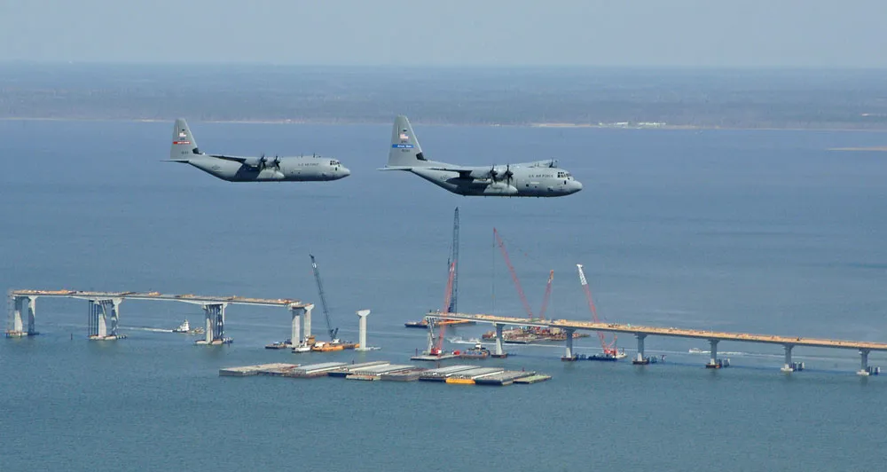
The current fleet is 10 WC-130J aircraft, which replaced the older WC-130H models between 1999 and 2005.3 The WC-130J usually works at 10,000 feet (3,000 m, the 700-millibar level), dropping to 5,000 feet (1,500 m) for weaker systems or when lower data is needed. Outside hurricane season the 53rd flies winter-storm and atmospheric-river reconnaissance over the Pacific, improving forecasts for West Coast rain and snow.
WP-3D Orion — NOAA's Flying Laboratory
NOAA's Aircraft Operations Center (AOC), based at Lakeland Linder International Airport in Lakeland, Florida, flies two Lockheed WP-3D Orions that rank among the most capable weather research platforms ever built. These two aircraft, N42RF ("Kermit") and N43RF ("Miss Piggy"), were built in 1975 and 1976, respectively, which puts them among the longest-serving aircraft in the entire federal fleet.4
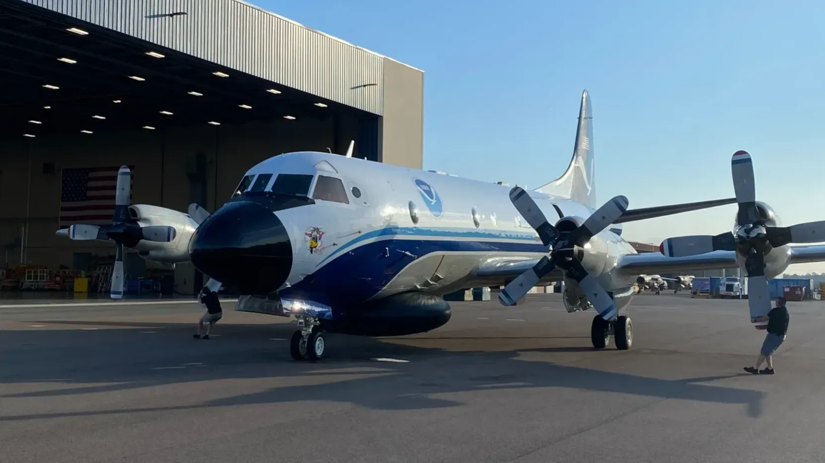
The WP-3D is built on the Lockheed P-3 Orion maritime-patrol aircraft, originally an anti-submarine platform. NOAA's variants run four T56-series turboprops, upgraded through NOAA’s service-life extension program. The aircraft can carry 12 to 20 people, a flight crew of about six plus scientists, technicians, and instrument operators. That large capacity is the whole point: the P-3 is a flying laboratory, where scientists monitor, adjust, and interpret the instruments in real time as the storm changes around them.
The P-3 carries research radars, SFMR, dropsondes and other instruments. Its tail Doppler radar supports three-dimensional wind analyses. No substantiated worldwide ranking of instrument counts is offered here.
Tail-Doppler analyses help researchers study storm structure. They have sampling and retrieval limitations and are not the only way to estimate a three-dimensional wind field.
The WP-3D typically works between 1,500 and 12,000 feet (460 and 3,700 m), with a range of about 3,800 nautical miles and endurance of 10 to 12 hours.4 Low-altitude penetration, heavy instrumentation, and long legs together make the P-3 uniquely suited to both operational reconnaissance and research. In a typical season the P-3s fly dual-purpose: operational data for NHC advisories and, on the same flight, research data that advances our understanding of hurricane structure and intensity change.5
NOAA awarded a contract in 2024 for two specialized C-130J replacements. The announcement projected fleet entry in 2030; this is an acquisition schedule, not evidence of current operational service.6
Gulfstream IV-SP
NOAA's Gulfstream IV-SP, tail number N49RF and nicknamed "Gonzo," plays an entirely different game from the low-altitude penetration aircraft. The G-IV doesn't fly through the hurricane. It circles it at high altitude, typically between 41,000 and 45,000 feet (12,500 and 13,700 m), on a mission-specific route around the storm.7 Its job is to sample the upper-tropospheric steering environment that decides where the hurricane tracks over the coming days.
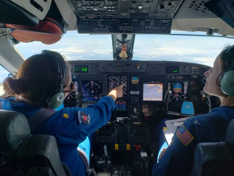
The G-IV is a twin-turbofan high-altitude research jet. NOAA publishes its configuration and performance specifications; mission range and endurance depend on flight conditions and payload.8
On a typical mission the G-IV drops 25 to 30 GPS dropsondes in a carefully planned pattern around the storm. Each falls on a small parachute, radioing back temperature, humidity, pressure, and wind at high vertical resolution from 45,000 feet (13,700 m) to the sea. That data defines the three-dimensional environment surrounding the hurricane, the very thing the track models need.
The G-IV began operational hurricane surveillance in 1997. Aberson (2010) evaluated a decade of surveillance; results depend on forecast system and sample, so a fixed 10–20% improvement or a lives-saved ranking between aircraft is not justified.7
NASA Global Hawk
NASA’s Global Hawk supported high-altitude, long-duration hurricane research, including GRIP and HS3. Mission endurance includes transit as well as time over the storm.
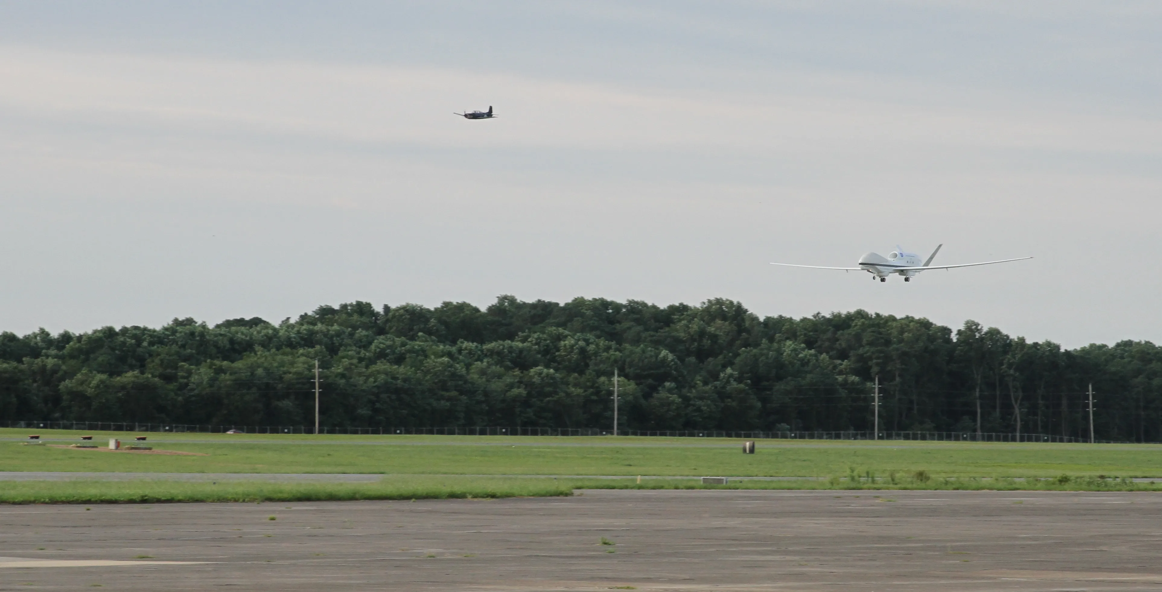
The Global Hawk cruises at about 357 mph (575 km/h) and can loiter over or near a hurricane for the better part of a day, giving continuous coverage no crewed aircraft can sustain. It carries GPS dropsondes and a suite of remote-sensing instruments that measure temperature, humidity, wind, and cloud properties from its perch in the lower stratosphere.
NASA flew the Global Hawk in hurricane research during the Genesis and Rapid Intensification Processes (GRIP) campaign in 2010 and the Hurricane and Severe Storm Sentinel (HS3) campaign from 2012 to 2014. Those missions showed it could sample a hurricane's environment over long stretches, capturing the storm's evolution in ways discrete crewed flights can't. It has flown mostly from NASA Armstrong Flight Research Center in California and NASA Wallops Flight Facility in Virginia.
For all its proven value, the Global Hawk hasn't yet moved into routine operational reconnaissance. Getting from research demonstration to operational deployment runs into real logistical, regulatory, and cost hurdles. Still, it has established that uncrewed, high-altitude, long-endurance platforms have a place in the future of hurricane observation, especially for storms over remote ocean where crewed aircraft run up against range and endurance.
Other Platforms and Historical Aircraft
Coyote UAS
The Coyote is a small expendable uncrewed aircraft from Raytheon, built to fly in the hurricane boundary layer below 2,000 feet (610 m), altitudes too dangerous for crewed flight inside a storm. With a wingspan of about 4.9 feet (1.5 m) and a weight near 6 kilograms, it's launched from a sonobuoy tube aboard NOAA's WP-3D while the P-3 stays higher up. Once away, the Coyote descends into the lowest levels of the storm to measure wind, temperature, humidity, and pressure in the air-sea layer, a region critical to intensity change and nearly impossible to observe any other way. Its first hurricane deployment came during Hurricane Edouard in 2014, and later missions have returned unprecedented data from the air-sea interface inside active hurricanes.
NOAA King Air
NOAA also operates Beechcraft King Air aircraft for coastal survey and damage assessment. After landfall, these aircraft fly over the affected areas to document storm-surge extent, structural damage, and coastal erosion. They don't penetrate storms, but the King Air fleet is important to post-storm response and recovery planning.
Historical Aircraft
Past weather-reconnaissance platforms include the WB-47, WC-121, DC-6 and Navy P2V. The 1955 Janet loss was not the last tropical-cyclone reconnaissance loss: six crew members of Swan 38 were lost in Typhoon Bess in 1974.9
Fleet Modernization
NOAA’s reconnaissance fleet requires long-term maintenance and replacement planning. For current aircraft and acquisition information, consult NOAA Aircraft Operations. Fleet descriptions and expected delivery dates can change.
The Air Force Reserve's 53rd WRS fleet is considerably newer, its WC-130Js having entered service between 1999 and 2005. Even so, those aircraft will eventually need modernizing or replacing. The C-130 has a long production run and is still in active manufacture, which gives a far more straightforward upgrade path than the one-of-a-kind WP-3D.
Uncrewed aircraft are advancing fast. Beyond the Global Hawk, platforms like the Altius and other medium-altitude long-endurance systems are being evaluated for hurricane roles, and the Coyote has already proven itself in the boundary layer. The future may well pair crewed penetration aircraft with high-altitude drones for continuous surveillance and expendable drones for the most dangerous regions of the storm. That multi-platform mix could give a far more complete picture than any single aircraft can.
The challenge isn't only technological; it's institutional. Moving from proven crewed platforms to new systems takes extensive testing, regulatory approval to fly uncrewed aircraft in national airspace, integration with the existing data pipelines, and training a new generation of operators and scientists. The next decade will likely bring the biggest change to the reconnaissance fleet since the transition from piston-engine aircraft to turboprops in the 1960s and 1970s, and understanding the instruments they carry is the best way to see what's at stake in the handoff.
Sources
-
Cione, J. J., et al. (2020). Eye of the storm: observing hurricanes with a small unmanned aircraft system. Bulletin of the American Meteorological Society, 101(2), E186–E205. https://doi.org/10.1175/BAMS-D-19-0169.1 ↩
-
403rd Wing WC-130J fact sheet. https://www.403wg.afrc.af.mil/About/Fact-Sheets/Display/Article/192525/wc-130j-hercules/ ↩ ↩2
-
National Hurricane Center. NHC Aircraft Reconnaissance. NOAA. "The ten Lockheed-Martin WC-130J aircraft and crews are part of the 403rd Wing, based at Keesler Air Force Base in Biloxi, Mississippi." https://www.nhc.noaa.gov/recon.php ↩
-
NOAA Aircraft Operations Center. Aircraft Fleet. Office of Marine and Aviation Operations. https://www.omao.noaa.gov/learn/aircraft-operations ↩ ↩2
-
Rogers, R., et al. (2013). NOAA's Hurricane Forecast Improvement Project Intensity Forecasting Experiment (IFEX): a progress report. Bulletin of the American Meteorological Society, 94(6), 859–882. https://doi.org/10.1175/BAMS-D-12-00089.1 ↩
-
NOAA replacement contract. https://www.omao.noaa.gov/omao/news-media/article/noaa-awards-contract-next-generation-hurricane-hunter-aircraft ↩
-
Aberson, S. D. (2010). 10 years of hurricane synoptic surveillance (1997–2006). Monthly Weather Review, 138(5), 1536–1549. https://doi.org/10.1175/2009MWR3090.1 ↩ ↩2
-
NOAA G-IV specifications. https://omao.noaa.gov/aircraft-operations/aircraft/gulfstream-iv-sp ↩
-
403rd Wing, Honoring Swan 38. https://www.403wg.afrc.af.mil/News/Article-Display/Article/1819689/honoring-swan-38/ ↩