For more than eight decades, men and women have flown aircraft, on purpose, into the most violent storms on Earth. What began as a wartime dare is now a multi-agency operation that forms the backbone of modern hurricane forecasting. Aircraft provide detailed in-situ observations that complement satellites, radar, buoys and other measurements. This article introduces the history, the organizations, the aircraft, and the data pathways that define hurricane aviation.
Why Fly Into Hurricanes?
Satellite observations include more than cloud-top pictures: microwave instruments can reveal internal precipitation structure and retrieve atmospheric properties. These remote estimates have uncertainty, as do aircraft measurements.1
Penetration aircraft measure flight-level conditions and deploy dropsondes for vertical profiles. Surface wind, pressure and structure are interpreted together; no single pressure observation defines a hurricane’s category.
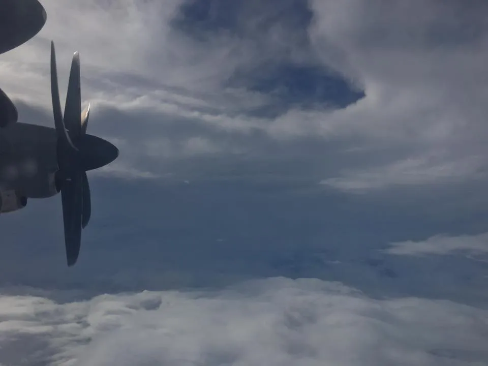
Central-pressure observations help forecasters assess storm intensity alongside wind measurements, satellite estimates, and the broader structure of the storm. Their value comes from how these observations are interpreted together.
The National Hurricane Center's official intensity estimates lean heavily on this reconnaissance. NHC specialists combine flight-level winds, Stepped Frequency Microwave Radiometer (SFMR) surface-wind estimates, and dropsonde pressures to pin down a storm's maximum sustained winds and minimum central pressure. Strip the aircraft data away and forecasters are left with satellite estimates alone, and far more uncertainty, in warnings that protect millions of people.
Aberson (2010) examined synoptic-surveillance observations over 1997–2006. Its findings should not be generalized into a fixed percentage improvement in every NHC track and intensity forecast. Effects depend on the observing system, model, case and lead time.2
Before aircraft, hurricane intensity could only be guessed from ship reports and coastal barometers. Ships gave the strongest storms a wide berth, and coastal stations only recorded conditions once a hurricane was already ashore. The interior of a hurricane at sea was, quite literally, unknown territory. Aircraft opened a window into these storms that no other platform has managed to replace.
A Brief History of Hurricane Reconnaissance
The whole enterprise begins with one act of nerve. On July 27, 1943, Lieutenant Colonel Joseph B. Duckworth, an instrument-flight instructor at Bryan Army Air Field in Texas, flew a single-engine North American AT-6 Texan trainer into a hurricane in the Gulf of Mexico near Galveston.3 It was part dare, part demonstration that instrument-flying technique could handle the turbulence inside a tropical cyclone. Duckworth punched through the eyewall, reached the calm eye, and came back. Then he flew it again the same day, this time with weather officer Lieutenant William Jones-Burdick aboard to take rough meteorological observations. Two flights, one afternoon, and the question of whether an aircraft could survive inside a hurricane was answered.
The military saw the value at once. In 1944 the Army Air Forces flew the first organized hurricane reconnaissance, with the first operational mission flown into the Great Atlantic Hurricane of September 1944 as it bore down on the East Coast. Those early flights set the pattern that still holds: fly into the storm, measure it, and get the data to forecasters.
Hurricane Janet claimed a Navy Neptune and eleven people in 1955. It was not the last tropical-cyclone reconnaissance loss: Swan 38 disappeared in Typhoon Bess in 1974 with six crew members.4
Civilian hurricane research grew alongside military reconnaissance through the Weather Bureau and its successors. NOAA’s aircraft program supports both operational observations and scientific experiments.
NOAA’s two WP-3D Orions were built in 1975 and 1976.5 The P-3, a modified Navy maritime-patrol aircraft, became the workhorse of hurricane research: four turboprops, long legs, and a cabin roomy enough for a laboratory's worth of instruments. Two were acquired, and both are still flying today, which makes them among the longest-serving research aircraft in the world.
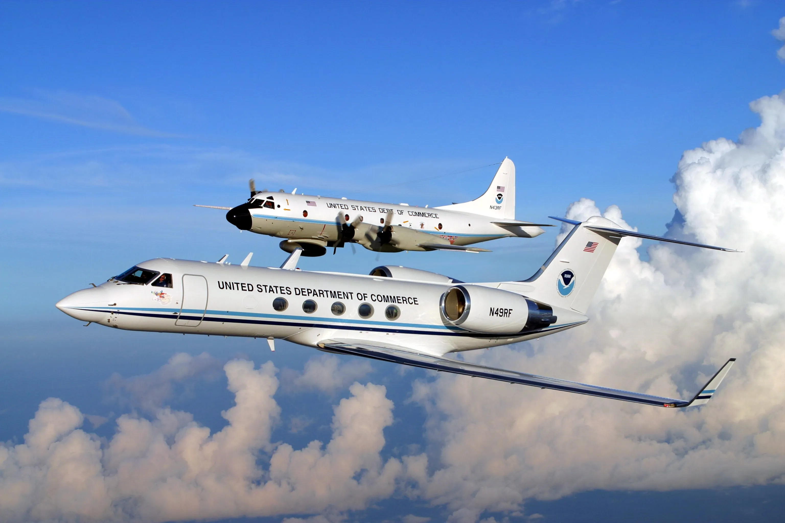
The fleet kept expanding. In 1997 a Gulfstream IV-SP joined NOAA for high-altitude synoptic surveillance.5 Where the P-3s bore through the storm down low, the G-IV cruises at 41,000 to 45,000 feet (12,500 to 13,700 m) around the storm's edges, dropping sondes to map the large-scale environment that steers it. On the military side, the 53rd Weather Reconnaissance Squadron completed its transition to WC-130J Super Hercules aircraft in 2005, retiring the older WC-130H for a more capable, more reliable platform.
Today three organizations fly into or around hurricanes: the U.S. Air Force Reserve's 53rd Weather Reconnaissance Squadron, NOAA's Aircraft Operations Center, and NASA, which runs periodic research campaigns with specialized platforms.
The Three Organizations
53rd Weather Reconnaissance Squadron (USAF Reserve)
The 53rd Weather Reconnaissance Squadron, better known as the "Hurricane Hunters," is part of the 403rd Wing, Air Force Reserve Command, based at Keesler Air Force Base in Biloxi, Mississippi. It's the only Department of Defense unit assigned the weather reconnaissance mission. The squadron flies ten WC-130J Super Hercules, each fitted with palletized weather instrumentation that can be rolled in or out as the mission demands.6
The 53rd is tasked by the National Hurricane Center through the National Hurricane Operations Plan (NHOP), a document NOAA and the Department of Defense publish jointly to govern reconnaissance.7 When NHC decides a storm needs surveillance, it issues a tasking, and the squadron launches. A typical mission means several passes through the center at 10,000 feet (3,000 m), each one refreshing the central pressure, the peak winds, and the shape of the eye.
Outside hurricane season the 53rd flies winter-storm reconnaissance over the Pacific and atmospheric-river missions off the West Coast, using the same dropsonde technology to sharpen precipitation forecasts. It's a reminder of how portable the basic idea turned out to be.
NOAA Aircraft Operations Center (AOC)
NOAA's Aircraft Operations Center, based at Lakeland Linder International Airport in Lakeland, Florida, operates the government's premier hurricane research aircraft. The fleet includes the two WP-3D Orions, N42RF ("Kermit") and N43RF ("Miss Piggy"), and the Gulfstream IV-SP, N49RF ("Gonzo"). The Muppet-themed names are an informal tradition that has stuck for decades, and the crews mean them affectionately.5
NOAA's P-3s fly both operational reconnaissance, much like the 53rd's, and research missions coordinated through NOAA's Hurricane Research Division (HRD) at the Atlantic Oceanographic and Meteorological Laboratory in Miami. The research flights are the more intricate of the two, flying patterns designed to map the three-dimensional wind field, deploy experimental sensors, or gather data for a specific study.
The Intensity Forecasting Experiment (IFEX) is one of the marquee campaigns flown on NOAA aircraft, aimed squarely at understanding and predicting intensity change, including rapid intensification and rapid weakening. Other campaigns have gone after storm-surge prediction, boundary-layer processes, and the way a hurricane and the ocean beneath it feed off each other.
The G-IV, meanwhile, flies synoptic surveillance, circling the storm at high altitude rather than crossing its core. By releasing sondes at regular intervals along its track, it maps the temperature, moisture, and wind around the hurricane, the environmental data that track models depend on.
NASA
NASA runs periodic research campaigns aimed at tropical cyclones, using platforms that complement NOAA's. The standout is the Northrop Grumman RQ-4 Global Hawk, an uncrewed aircraft that can fly at 55,000 to 65,000 feet (17,000 to 20,000 m) for more than 24 hours at a stretch. From up there it samples the upper troposphere and lower stratosphere in ways no other reconnaissance platform can.
NASA's Genesis and Rapid Intensification Processes (GRIP) campaign in 2010 and the Hurricane and Severe Storm Sentinel (HS3) campaign from 2012 to 2014 paired the Global Hawk with other aircraft to study why some disturbances become hurricanes and why some hurricanes rapidly intensify while others fizzle. The ER-2, a civilian cousin of the U-2 spy plane, has flown hurricane research too, taking high-altitude measurements and serving as a testbed for prototype satellite instruments.
How Reconnaissance Data Reaches Forecasters
Reconnaissance is only worth as much as its speed and accuracy in reaching forecasters and models. A real-time transmission system gets observations from inside a hurricane to the National Hurricane Center within minutes.
Aircraft encode their observations in standardized message formats. The most important is the Vortex Data Message (VDM), sent each time the aircraft crosses or passes near the center. The VDM carries the parameters NHC uses to judge intensity: the center's latitude and longitude, the central pressure (from a dropsonde, or extrapolated from flight level), the maximum flight-level wind, the maximum surface wind from the SFMR, and a description of the eye, including its diameter and wall structure.
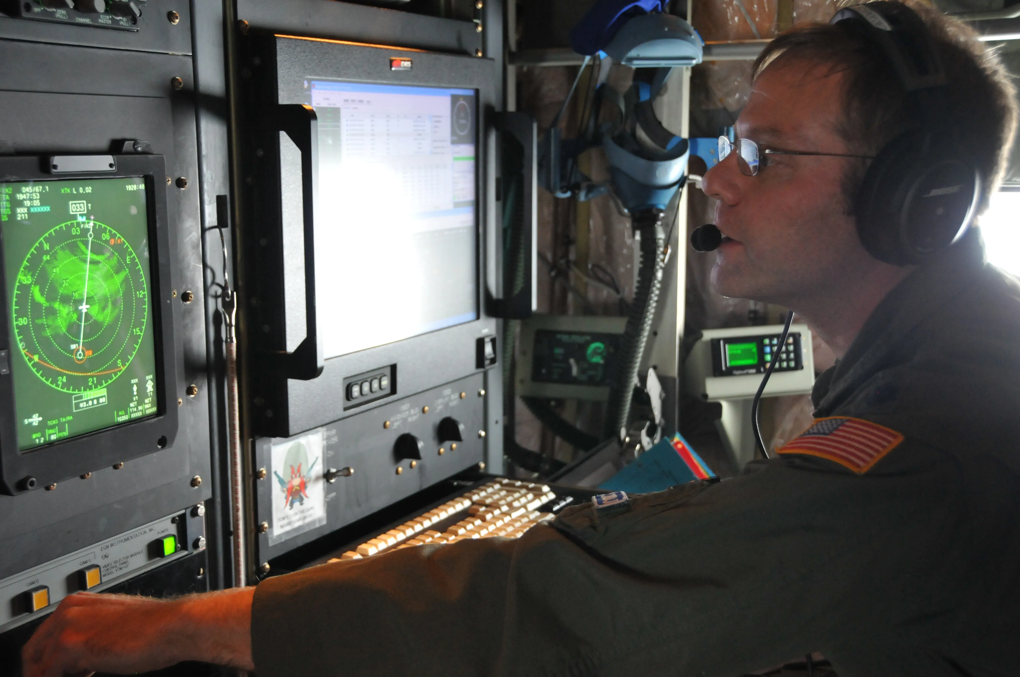
These messages travel by satellite to NHC in Miami in real time. The specialists on duty get the data at once and update their read of the storm's position and strength. When a fresh VDM shows something significant, a pressure drop that signals rapid intensification, or a jump in the center's position, forecasters can revise the official advisory on the spot.
Beyond the VDM, aircraft transmit continuous high-density observations (HDOBs), reporting flight-level parameters every 30 seconds throughout the mission. Together they build a detailed portrait of the storm's radial wind profile, temperature structure, and pressure field. Dropsonde profiles, full verticals of wind, temperature, and humidity, go out for assimilation into the numerical models.
That assimilation is the critical link. The GFS (Global Forecast System), ECMWF (European Centre for Medium-Range Weather Forecasts), HWRF (Hurricane Weather Research and Forecasting), HMON (Hurricanes in a Multi-scale Ocean-coupled Non-hydrostatic), and the newer HAFS (Hurricane Analysis and Forecast System) all ingest reconnaissance to improve their picture of the storm and its surroundings. At NHC, the Automated Tropical Cyclone Forecasting System (ATCF) fuses everything, aircraft, satellites, buoys, ships, and models, into one analysis-and-forecast framework.
The Impact on Forecasting
Reconnaissance expanded observations over the ocean, where early forecasters had sparse information. Galveston in 1900 illustrates limitations in observation, interpretation and communication; the United States already had a weather-warning service, so it is inaccurate to say there was no organized warning system.
Regular reconnaissance in the 1940s and 1950s sharply cut the number of surprise landfalls. Forecasters could now confirm a storm's existence, its location, and its rough intensity days before it threatened land. Paired with the growing network of radar and surface observations, that let them issue warnings early enough to give coastal populations hours or days to prepare and get out.
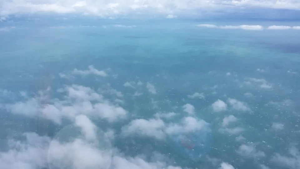
NHC verification shows long-term improvements in track and intensity forecasts. Quantifying the contribution of aircraft requires controlled comparisons; broad historical trends also reflect models, satellites and other changes.
Dvorak and other satellite methods are particularly important where routine aircraft observations are unavailable. Pacific intensity analyses can also use microwave imagery, scatterometry, radar and surface reports; Dvorak is not their sole basis.
Aircraft observations remain valuable because they sample parts of a storm that are difficult to measure remotely. Their role is best understood alongside the instruments and mission methods.
Sources
-
NOAA Atlantic Oceanographic and Meteorological Laboratory, Hurricane Research Division. Tropical Cyclone FAQ H1: What is the Dvorak technique and how is it used? "Vern Dvorak developed the scheme using a pattern recognition decision tree in the early 1970s ... an Atlantic hurricane that is given a CI number of 4.5 (winds of 77 kt and pressure of 979 mb) could in reality be anywhere from winds of 60 to 90 kt." https://www.aoml.noaa.gov/hrd/tcfaq/H1.html ↩
-
Aberson, S. D. (2010). 10 years of hurricane synoptic surveillance (1997–2006). Monthly Weather Review, 138(5), 1536–1549. https://doi.org/10.1175/2009MWR3090.1 ↩
-
NOAA Atlantic Oceanographic and Meteorological Laboratory. Seventieth Anniversary of Hurricane Reconnaissance. On July 27, 1943, Lt. Col. Joseph Duckworth flew his AT-6 "Texan" trainer into the hurricane that struck Galveston, "encountered moderate turbulence but succeeded in finding the eye," then made a second flight carrying weather officer Lt. William Jones-Burdick. https://www.aoml.noaa.gov/hurricane_blog/seventieth-anniversary-of-hurricane-reconnaissance/ ↩
-
403rd Wing, Honoring Swan 38. https://www.403wg.afrc.af.mil/News/Article-Display/Article/1819689/honoring-swan-38/ ↩
-
NOAA Aircraft Operations Center. Aircraft. https://www.omao.noaa.gov/learn/aircraft-operations ↩ ↩2 ↩3
-
National Hurricane Center. NHC Aircraft Reconnaissance. NOAA. "The 53rd Weather Reconnaissance Squadron, known as the Hurricane Hunters of the Air Force Reserve, is the only Department of Defense organization still flying into tropical storms and hurricanes – since 1944. The ten Lockheed-Martin WC-130J aircraft and crews are part of the 403rd Wing, based at Keesler Air Force Base in Biloxi, Mississippi." https://www.nhc.noaa.gov/recon.php ↩
-
National Hurricane Center. Reconnaissance. NOAA. https://www.nhc.noaa.gov/recon.php ↩