When a hurricane's winds leap from Category 1 to Category 4 in a single day, the transformation almost always begins in one place: the eyewall. This ring of towering thunderstorms encircling the calm eye is where a hurricane concentrates its energy, produces its strongest winds, and undergoes the explosive strengthening that makes intensity forecasting one of meteorology's hardest problems.
What Is the Eyewall?
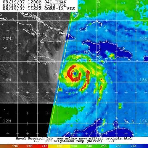
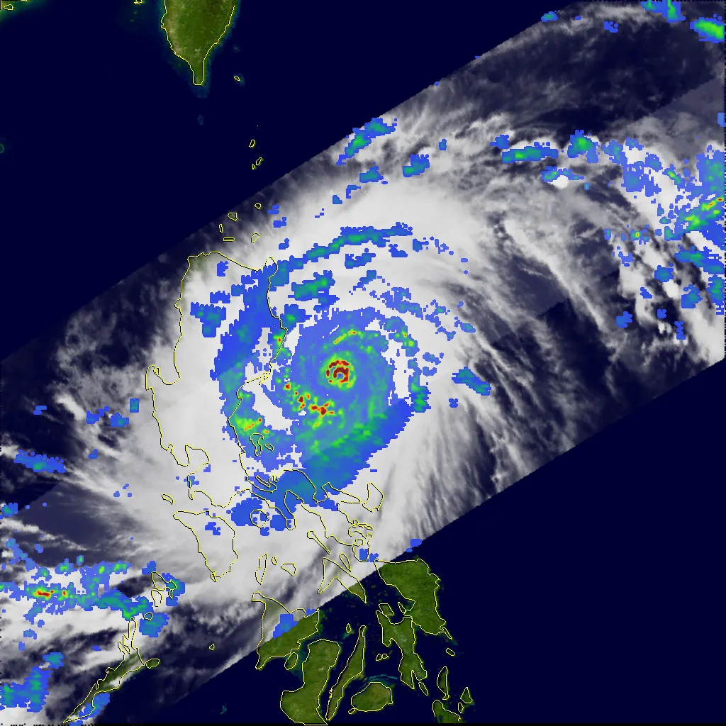
The eyewall is the ring of deep convection (tall, intense thunderstorms) that surrounds the eye of a tropical cyclone, and it is the region where the strongest winds and intense rainfall occur; the lowest surface pressure is normally in the eye.1 Warm, moist air spirals inward across the ocean surface, rises violently within the eyewall, and releases enormous amounts of latent heat as its water vapor condenses. That heat lowers the central pressure, which accelerates the inflow, a self-reinforcing loop that powers the storm.
The fastest winds generally occur near the inner edge of the eyewall, at the radius of maximum winds. Inside that radius, in the eye itself, air gently sinks, skies can clear, and winds fall to near calm, the deceptive lull between the two passages of the eyewall as a storm moves over a location.

The Eyewall as the Engine of Intensity
A hurricane's peak possible strength is set by thermodynamics. Potential-intensity theory shows that the maximum wind a storm can reach depends on the heat available from the ocean surface and the temperature of the upper atmosphere into which the storm exhausts its air; warmer seas raise that ceiling.2 But reaching it requires the eyewall to organize efficiently, and many storms never approach their potential intensity because hostile conditions interfere.

Rapid Intensification
Rapid intensification (RI) is formally defined as an increase in a tropical cyclone's maximum sustained winds of at least 35 mph (56 km/h; 30 kt) within 24 hours.3 It is among the most dangerous behaviors a hurricane can exhibit: a storm that looks manageable in the morning can become catastrophic by the next day, leaving little time to evacuate. The eastern Pacific's Hurricane Patricia (2015) is the modern benchmark for explosive strengthening.

What Drives Rapid Intensification
Analyzing decades of Atlantic storms, Kaplan and DeMaria found that rapidly intensifying systems share a recognizable environment: unusually warm sea surface temperatures and deep ocean heat content, weak vertical wind shear, abundant mid-level moisture, and a storm already operating below its potential intensity.3 When these align, the eyewall can contract and concentrate its winds over a smaller radius, spinning up much like a skater pulling in their arms. Deep, warm water matters as much as surface warmth: a shallow warm layer is quickly churned cold by the storm's own winds, cutting off the fuel supply.2 The proportion of storms undergoing rapid intensification appears to be rising as the oceans warm, a trend examined in our article on climate change and hurricane intensity.
Eyewall Replacement Cycles
Intense hurricanes, generally Category 3 and stronger, often interrupt their own intensification through an eyewall replacement cycle. A second ring of thunderstorms forms outside the original eyewall, then contracts and chokes off the inner eyewall's inflow.4 During the replacement, the inner eyewall collapses and peak winds temporarily fall, even as the storm's wind field broadens. Once the outer eyewall takes over and contracts, the hurricane can re-intensify. These cycles, first described in detail by Willoughby and colleagues, are a major reason a major hurricane's intensity can swing over just a few hours.4
Why Forecasting Intensity Remains So Hard
NHC verification shows long-term improvements in both track and intensity forecasts. Rapid intensification remains challenging because it involves interactions across scales and incomplete observations. The 2014 guidance study is historical context; current performance should be assessed from the latest NHC verification.
Track and intensity forecasts answer different questions and have different errors. Consult the latest NHC forecast and discussion for both; uncertainty in intensity is a reason to prepare for the stated hazards, not to disregard the forecast.
Sources
-
National Hurricane Center. Glossary of NHC Terms. NOAA. https://www.nhc.noaa.gov/aboutgloss.shtml ↩
-
Emanuel, K. (2005). Divine Wind: The History and Science of Hurricanes. Oxford University Press. https://academic.oup.com/book/54547 ↩ ↩2
-
Kaplan, J., & DeMaria, M. (2003). Large-scale characteristics of rapidly intensifying tropical cyclones in the North Atlantic basin. Weather and Forecasting, 18(6), 1093–1108. https://doi.org/10.1175/1520-0434(2003)018%3C1093:LCORIT%3E2.0.CO;2 ↩ ↩2
-
Willoughby, H. E., Clos, J. A., & Shoreibah, M. G. (1982). Concentric eyewalls, secondary wind maxima, and the evolution of the hurricane vortex. Journal of the Atmospheric Sciences, 39(2), 395–411. https://doi.org/10.1175/1520-0469(1982)039%3C0395:CEWSWM%3E2.0.CO;2 ↩ ↩2