Hurricane formation requires thunderstorms and a low-level circulation to organize and persist. Warm water helps supply energy, but the surrounding atmosphere and the storm’s structure also matter.
Five Favorable Conditions
Meteorologists look for several favorable conditions. These are useful guidelines, not a checklist of absolute cutoffs: unusual formation pathways and exceptions exist.
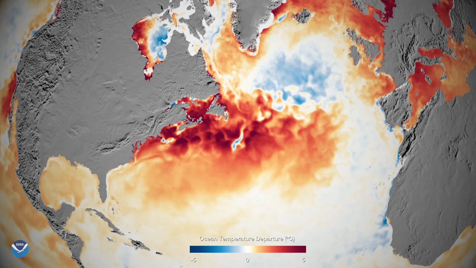
1. Warm Ocean Water (80°F / 26.5°C or Warmer)
Hurricanes draw energy from ocean-to-atmosphere heat and moisture transfer. Water around 80°F (26.5°C) or warmer extending through a substantial upper-ocean layer is a common favorable condition. There is no abrupt change in evaporation at that temperature, and cooler-water formation can occur when the atmospheric temperature profile is favorable. Deep warm water can reduce the cooling caused by a storm’s own winds.1
2. Atmospheric Moisture and Instability
Warm, moist air near the surface and sufficient moisture through the lower and middle atmosphere favor deep convection. Rising air cools, and condensation releases latent heat. Buoyancy depends on temperature and moisture relative to the surroundings; dry air aloft is not a required ingredient and can disrupt convection.
3. Low Wind Shear
Wind shear is the change in wind speed or direction with height. Strong shear tears developing storms apart. It displaces the convection far from the low-pressure center, preventing it from becoming organized. Weak shear allows thunderstorms to align vertically. Air rising in deep thunderstorms spreads outward near the top of the storm; low-level inflow supplies warm, moist air below. For hurricane development, wind shear must be weak throughout the lower and middle troposphere.2 This requirement eliminates much of the subtropics and temperate zones, where the jet stream generates strong shear.
4. Distance from the Equator (Coriolis Effect)
The Coriolis parameter is zero at the equator and increases in magnitude away from it. Most tropical cyclones develop beyond about 5 degrees latitude, but rare storms form closer when other sources of rotation and favorable conditions are present. Five degrees is a guideline, not an absolute boundary.3
5. A Pre-Existing Disturbance
Even with all four atmospheric and oceanic ingredients in place, something must trigger organization. Wind does not spontaneously begin rotating around a point in the atmosphere. A disturbance is needed. This may be an African easterly wave, a weak area of low pressure, remnants of a frontal boundary, or another organized area of rising air. Once this disturbance begins to spin, the feedback between evaporation, convection, and circulation can sustain and amplify growth.
African Easterly Waves: Birthplace of Hurricanes
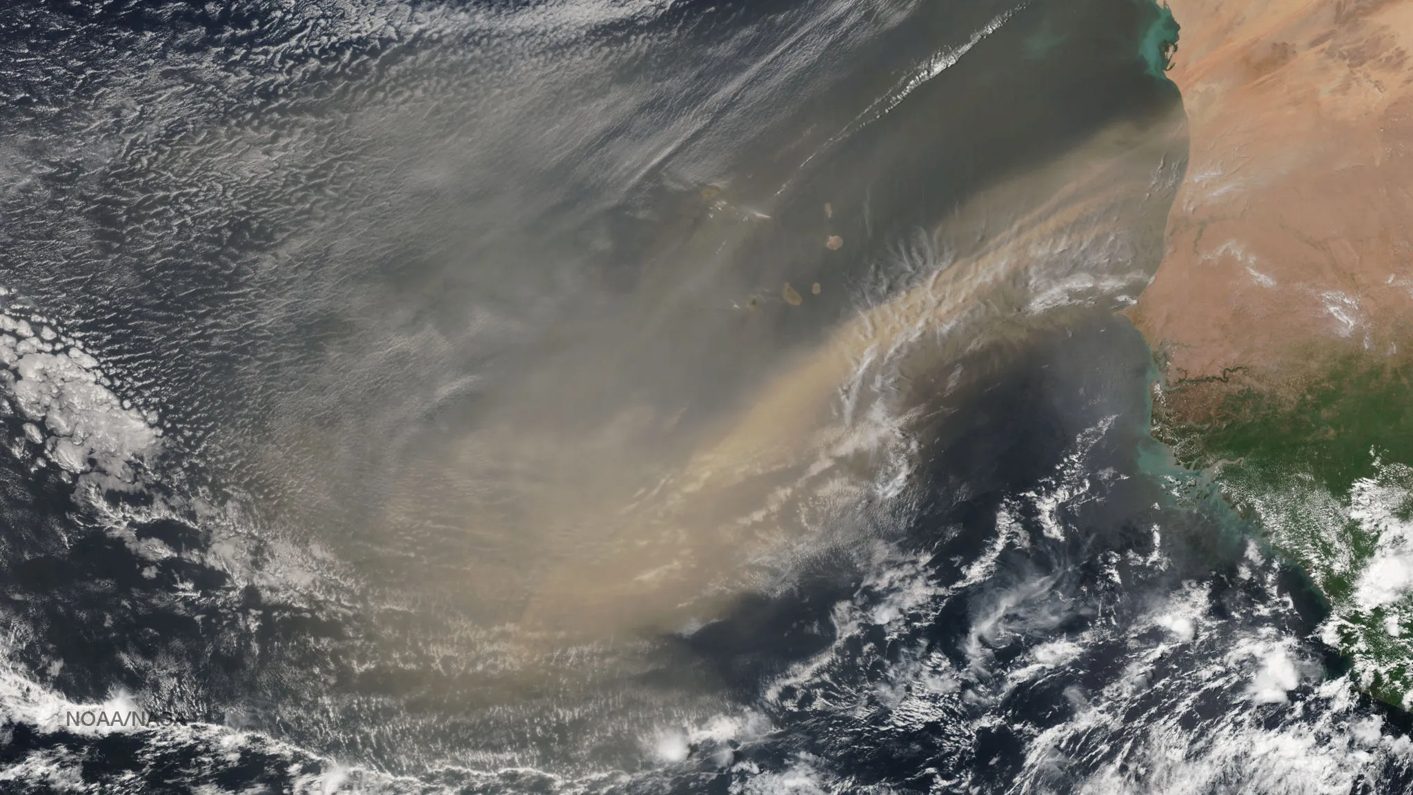
More than half of all Atlantic hurricanes originate from a single mechanism: the African easterly wave.4 These are ripples embedded in the deep trade winds that flow from East Africa across the Atlantic. Each summer, a procession of these waves leaves the coast of West Africa, marches westward, and spends the next two weeks crossing the Atlantic Ocean. Most dissipate. But those that encounter warm ocean water, low wind shear, and sufficient Coriolis effect can grow dramatically.
African easterly waves are disturbances associated with the African easterly jet and convection over Africa. The north–south temperature contrast helps establish the jet, but wave formation involves more than an oscillating boundary. Only some waves develop into tropical cyclones.
African easterly waves vary in strength and organization. Some develop over the tropical Atlantic, particularly during the later summer and autumn peak of the season. Others cross the ocean without becoming tropical cyclones. Travel time and the warning available at a particular coast depend on the track and speed.
The Formation Process: Step by Step
Development can be gradual or rapid. The following outline combines official classifications with the processes of intensification and decay; it is not an official five-stage sequence.
Stage 1: Tropical Disturbance
A tropical disturbance is a poorly organized area of thunderstorms with a weak surface circulation. Wind convergence is not yet clearly organized around a center. The disturbance may persist for a day or several days. Most disturbances remain weak and dissipate. But if conditions are favorable, organized convection begins to align, and a circulation develops.
Stage 2: Tropical Depression
A tropical depression is the first official stage of tropical cyclone development. It meets the basic criterion: a closed circulation with sustained winds below 39 miles per hour (63 kilometers per hour). At this stage, satellite imagery and surface observations reveal a coherent wind pattern rotating around a defined center. Cloud tops are cold, indicating strong updrafts. However, the storm is not yet formally named. Some depressions intensify into named storms and hurricanes; others dissipate.
Stage 3: Tropical Storm
When sustained winds reach 39 miles per hour (63 kilometers per hour), the system earns an official name and is classified as a tropical storm. At this threshold, structural organization becomes clear. A more defined eye may begin to form. Spiral rainbands become apparent on satellite. The storm has overcome a critical threshold. Tropical storms cause notable impacts from wind and rain, and their flooding can be catastrophic even without hurricane-force winds.
Stage 4: Hurricane
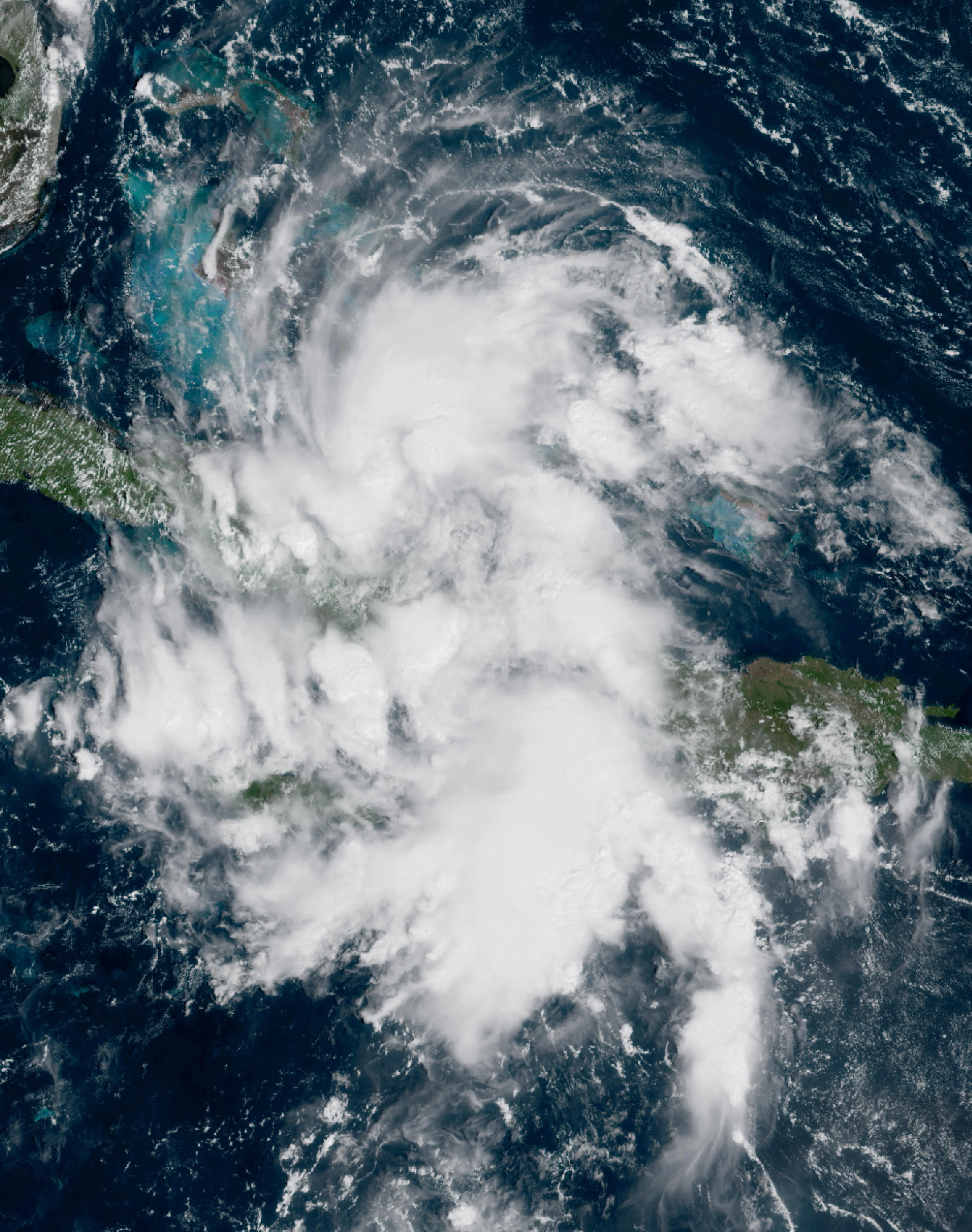
At 74 miles per hour (119 kilometers per hour), the system becomes a hurricane. The eye is typically well-defined. The eyewall is a ring of intense thunderstorms surrounding the eye. Pressure has fallen significantly from the initial depression stage. A Category 1 hurricane on the Saffir-Simpson scale represents a major milestone: sustained winds of 74 to 95 miles per hour (119 to 153 kilometers per hour). Damage depends on construction, exposure, duration, and local hazards as well as maximum sustained wind.
Stage 5: Intensification or Decay
Once a hurricane forms, it may continue to strengthen if environmental conditions remain favorable. Rapid intensification can occur in as little as 12 hours when the ocean is exceptionally warm, moisture is abundant, and wind shear is minimal. Alternatively, the hurricane may weaken if it encounters cooler water, moves over land, or finds itself in a region of high wind shear. Lifetimes vary greatly, and the time spent at hurricane strength is shorter than the full lifetime of many tropical cyclones.
The Ocean's Critical Role in Storm Development
The ocean does more than provide warm water. It is an active participant in hurricane dynamics. Ocean heat content, defined as the total thermal energy in the upper ocean layers, varies dramatically with season and location. High upper-ocean heat content can limit storm-induced cooling, but atmospheric conditions also control intensity.
The Thermocline and Entrainment
Beneath the warm surface layer lies the thermocline, a zone of rapidly decreasing temperature. When a hurricane moves, it generates waves that mix the ocean surface, bringing cooler water from below to the top. Turbulent mixing and wind-driven upwelling are distinct processes that can both cool the surface. If the thermocline is shallow and the cooler water beneath it is very cold, the developing hurricane can cool its own energy source. This self-limiting feedback explains why some hurricanes plateau in intensity despite favorable atmospheric conditions. Conversely, where the thermocline is deep and warm water extends to great depth, hurricanes can intensify more readily and dissipate more slowly.
This feedback is also one reason we couple the ocean to the atmosphere in formation and intensity models. A disturbance sitting over a shallow warm layer can stall itself, and a model that treats the sea as a fixed-temperature slab will get the outcome wrong.
Why Shallow Warm Water Alone Is Insufficient
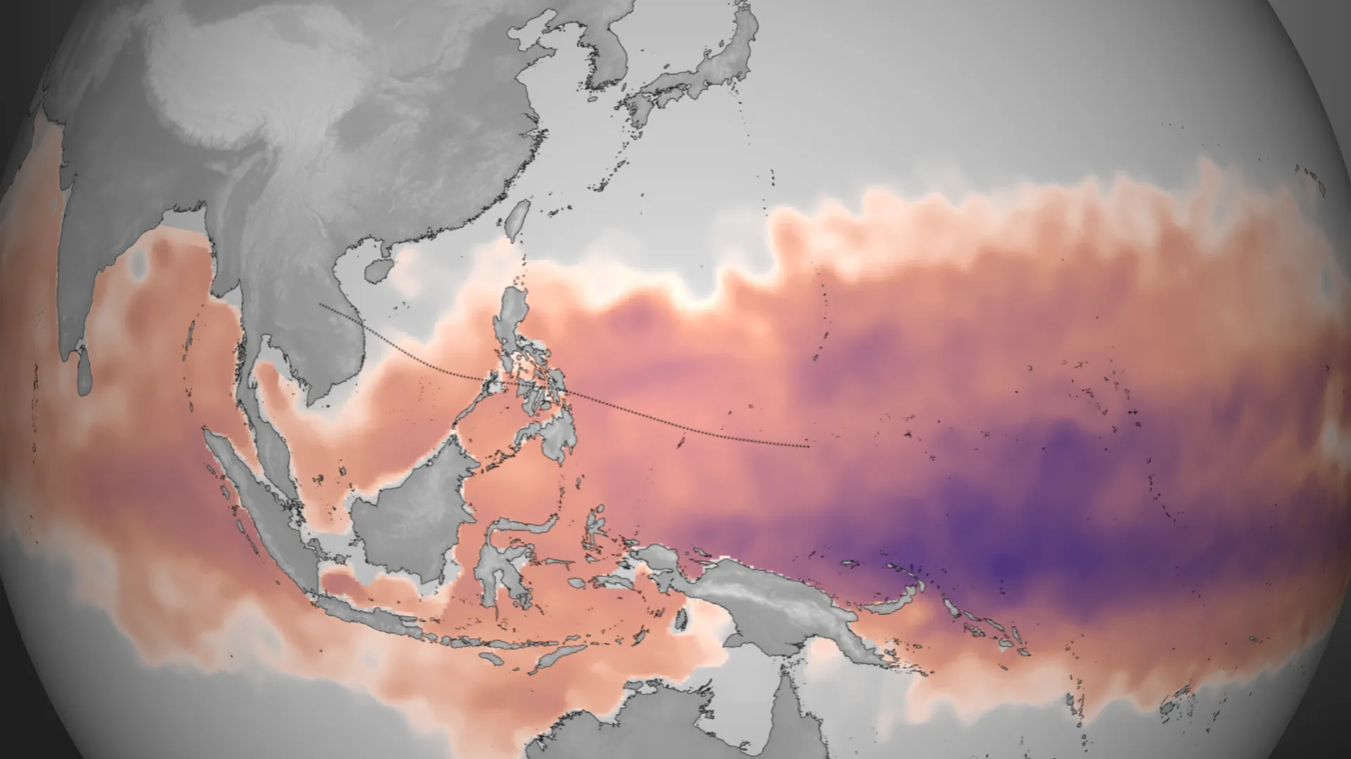
A small warm body of water cannot supply the heat and moisture flux over the broad area involved in a tropical cyclone. Over the ocean, the depth and temperature of the warm layer influence how much the surface cools under strong winds. Water depth alone does not decide whether a storm can develop.
Why Most Disturbances Fail to Become Hurricanes
Many tropical disturbances never develop. Their development rate depends on how disturbances are defined, the basin, season, and dataset.
The Saharan Air Layer
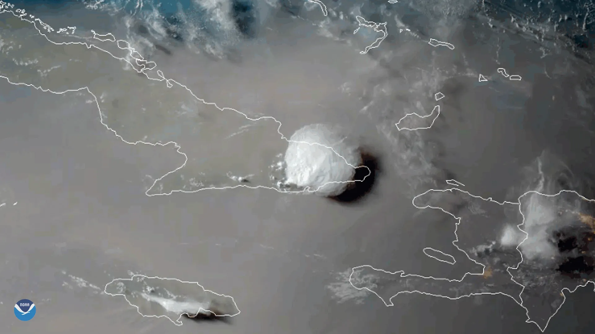
During African easterly wave season, dry air from the Sahara Desert is lofted westward at mid-levels (around 15,000 feet, or 4,600 meters) of the atmosphere. This Saharan Air Layer (SAL) is exceptionally dry. When it encounters a developing tropical cyclone, it can be entrained into the storm. Dry air stabilizes the atmosphere and suppresses convection. A developing storm that encounters the SAL may lose its organized structure and weaken. The strength of the SAL varies seasonally. Years with a strong SAL tend to produce fewer Atlantic hurricanes.
Wind Shear and Hostile Environments
Even in regions where the ocean is warm, environmental wind shear can prevent development. The jet stream in the subtropics generates strong shear. Many tropical disturbances that form over warm water in the Gulf of Mexico or Caribbean find themselves in this shear-dominated environment. The shear tears apart the convection before organization can proceed. The disturbance may intensify briefly, then weaken. This explains why not all disturbances over warm water develop into hurricanes.
Dry Air Intrusions and Subsidence
Dry air can intrude from surrounding regions not just via the Saharan Air Layer but through other pathways. Upper-level subsidence, a gradual sinking of air, can warm the middle troposphere and suppress rising motion. A developing storm can find itself in an environment where the atmosphere resists vertical motion. Without strong convection, organization fails, and the disturbance remains weak.
Where Do Hurricanes Form?
Hurricane formation is not uniformly distributed across the tropics. Certain regions are more favorable than others.
The Main Development Region (MDR)
The Atlantic Main Development Region generally refers to the tropical Atlantic and Caribbean; exact boundaries vary by study. It is an important source region for Atlantic hurricanes, especially near the seasonal peak.
Cape Verde Storms vs. Gulf Storms
Hurricanes that originate near the Cape Verde islands off West Africa (called Cape Verde hurricanes) traverse the open Atlantic. They have more time to develop and often become stronger. Hurricanes that form in the Gulf of Mexico or Caribbean typically develop from locally-generated disturbances or waves that reach these regions. Gulf storms often intensify rapidly but may weaken quickly after landfall. Atlantic storms, by contrast, may persist for longer periods due to their longer exposure to warm water.
Favorable and Unfavorable Seasons
Not all years produce the same number of hurricanes. Major climate patterns modulate hurricane frequency on seasonal and decadal timescales.
El Niño and La Niña
El Niño years, marked by above-average sea surface temperatures in the eastern Pacific and altered atmospheric circulation globally, tend to produce fewer Atlantic hurricanes. The altered wind patterns include increased wind shear over the Atlantic. This hostile environment suppresses development. La Niña years show the opposite effect. Enhanced Atlantic hurricane activity is typical during strong La Niña events. ENSO changes the odds of an active season; it does not determine an exact number of hurricanes.
The Atlantic Multidecadal Oscillation (AMO)
Atlantic sea-surface temperatures and hurricane activity vary over decades. Internal ocean–atmosphere variability and external influences, including greenhouse gases and aerosols, contribute. Treating this as a fixed natural clock would overstate scientific agreement.
The Madden-Julian Oscillation (MJO)
On shorter timescales, the Madden-Julian Oscillation, a pattern of atmospheric convection that circles the Earth roughly every 30 to 60 days, modulates hurricane formation. During certain phases of the MJO, wind shear over the Atlantic is reduced, favoring hurricane development. During other phases, shear is enhanced, suppressing development. Seasonal forecasters use MJO predictions to refine week-to-week hurricane outlooks.
From Formation to Intensity
These favorable conditions help explain where and when hurricanes develop. Warm water, moisture, weak shear, and an organized disturbance are useful indicators, but none guarantees development. Once a disturbance clears that bar, the story shifts to how strong the storm can get and how fast it gets there, which is where eyewall dynamics and rapid intensification take over.
Sources
-
NOAA Ocean Service. How do hurricanes form?. Favorable conditions; read alongside NOAA hurricane FAQs for exceptions and basin differences. ↩
-
Emanuel, K. (2003). Tropical cyclones. Annual Review of Earth and Planetary Sciences, 31(1), 75–104. https://doi.org/10.1146/annurev.earth.31.100901.141259 ↩
-
Gray, W. M. (1968). Global view of the origin of tropical disturbances and storms. Monthly Weather Review, 96(10), 669–700. https://doi.org/10.1175/1520-0493(1968)096%3C0669:GVOTOO%3E2.0.CO;2 ↩
-
National Hurricane Center. (2024). Tropical Cyclone Climatology. NOAA. https://www.nhc.noaa.gov/climo/ ↩