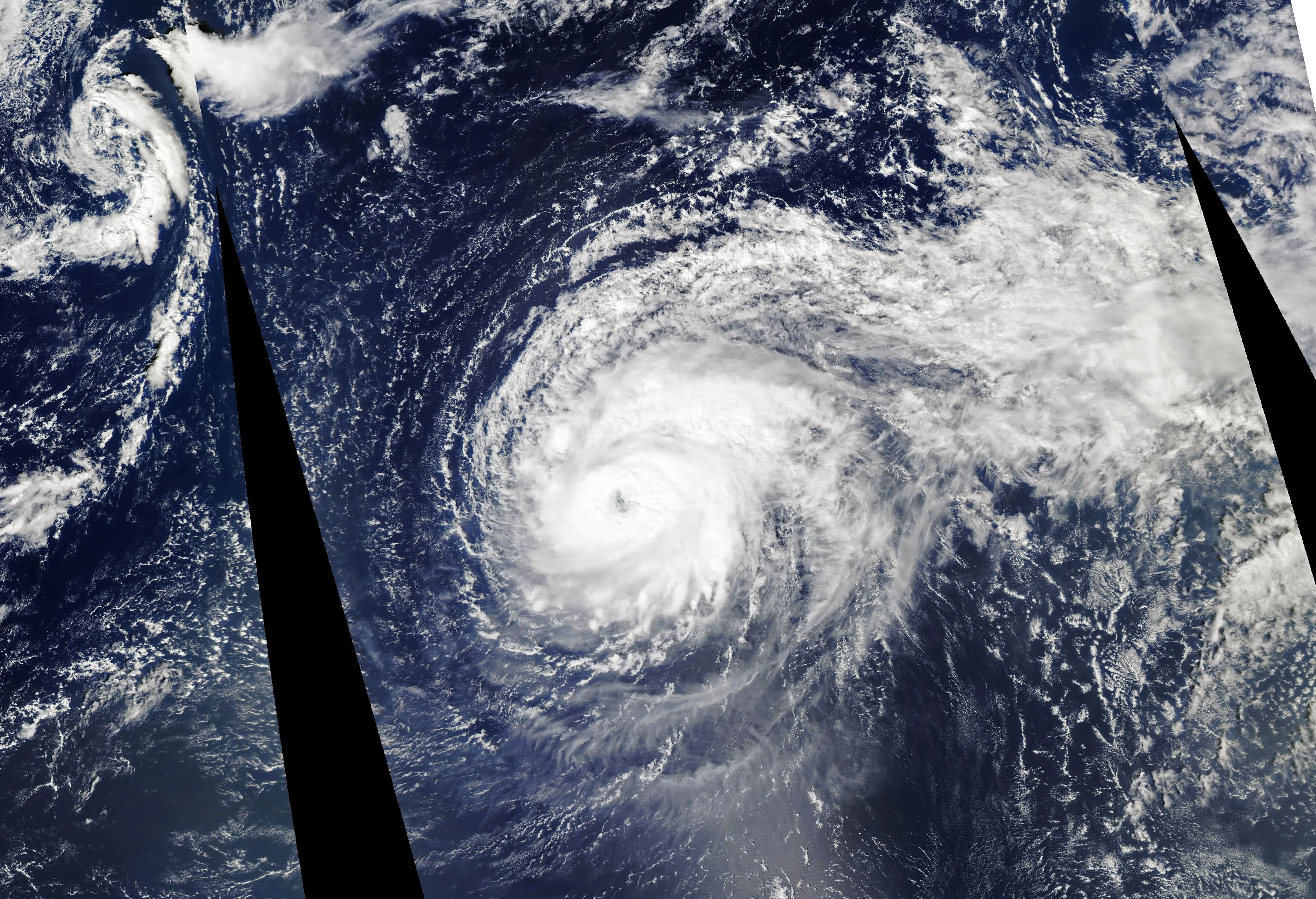
A hurricane is a highly organized thermodynamic engine with distinct structural components, each playing a specific role and posing a specific threat. Knowing the anatomy, from the deceptively calm eye to the violent eyewall and the sprawling outer rainbands, reveals where the greatest dangers lie and why a hurricane's behavior can be so complex.
The Eye
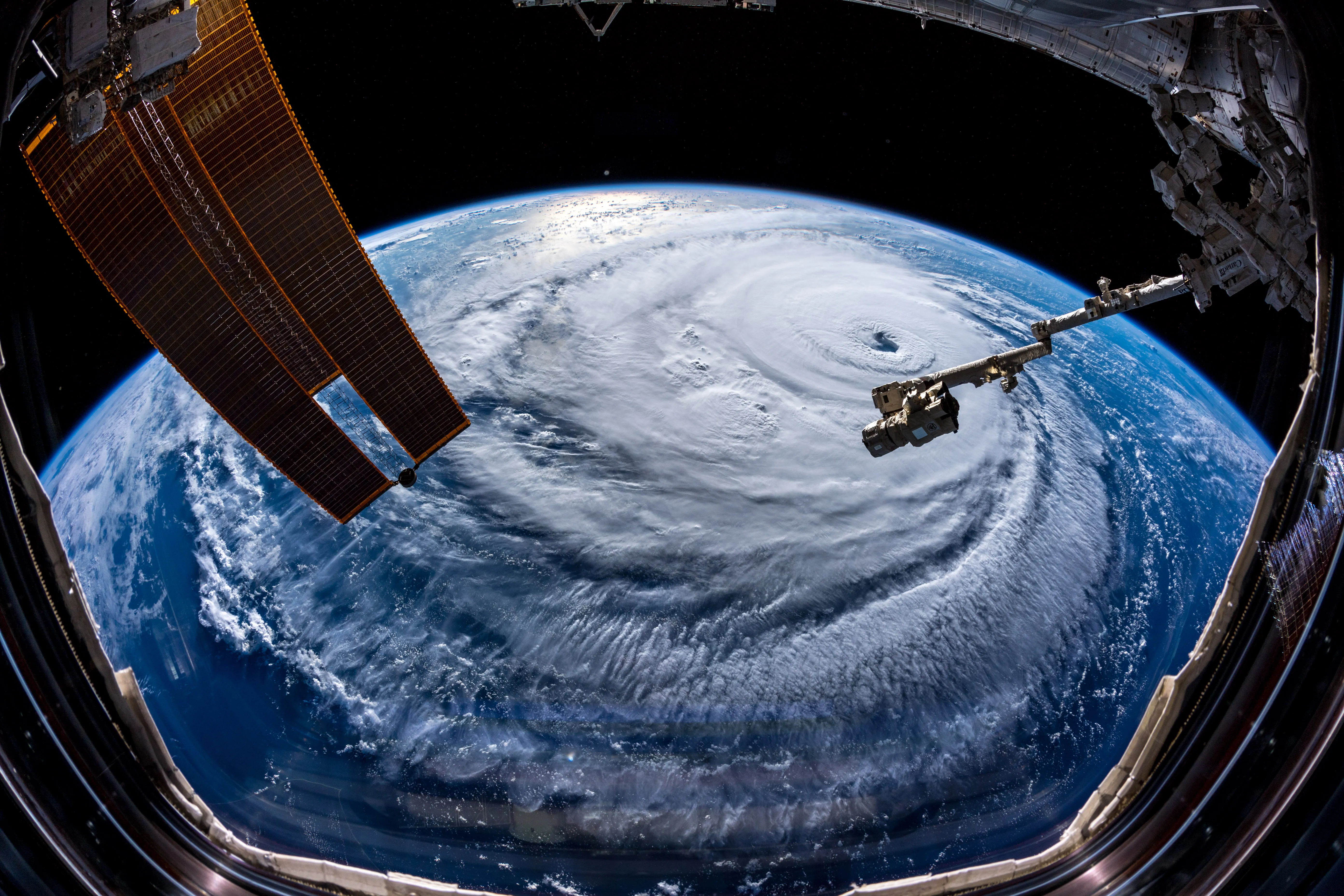
At the center is the eye, a region of light winds and often clear skies where air gently sinks.1 Eyes typically span about 20 to 40 miles (30 to 65 kilometers) across, though the most intense, compact hurricanes can have eyes only a few kilometers wide. The calm is deceptive: it is ringed by the storm's most violent weather, and people caught in the eye at landfall sometimes mistake the lull for the storm's end before the opposite eyewall arrives.
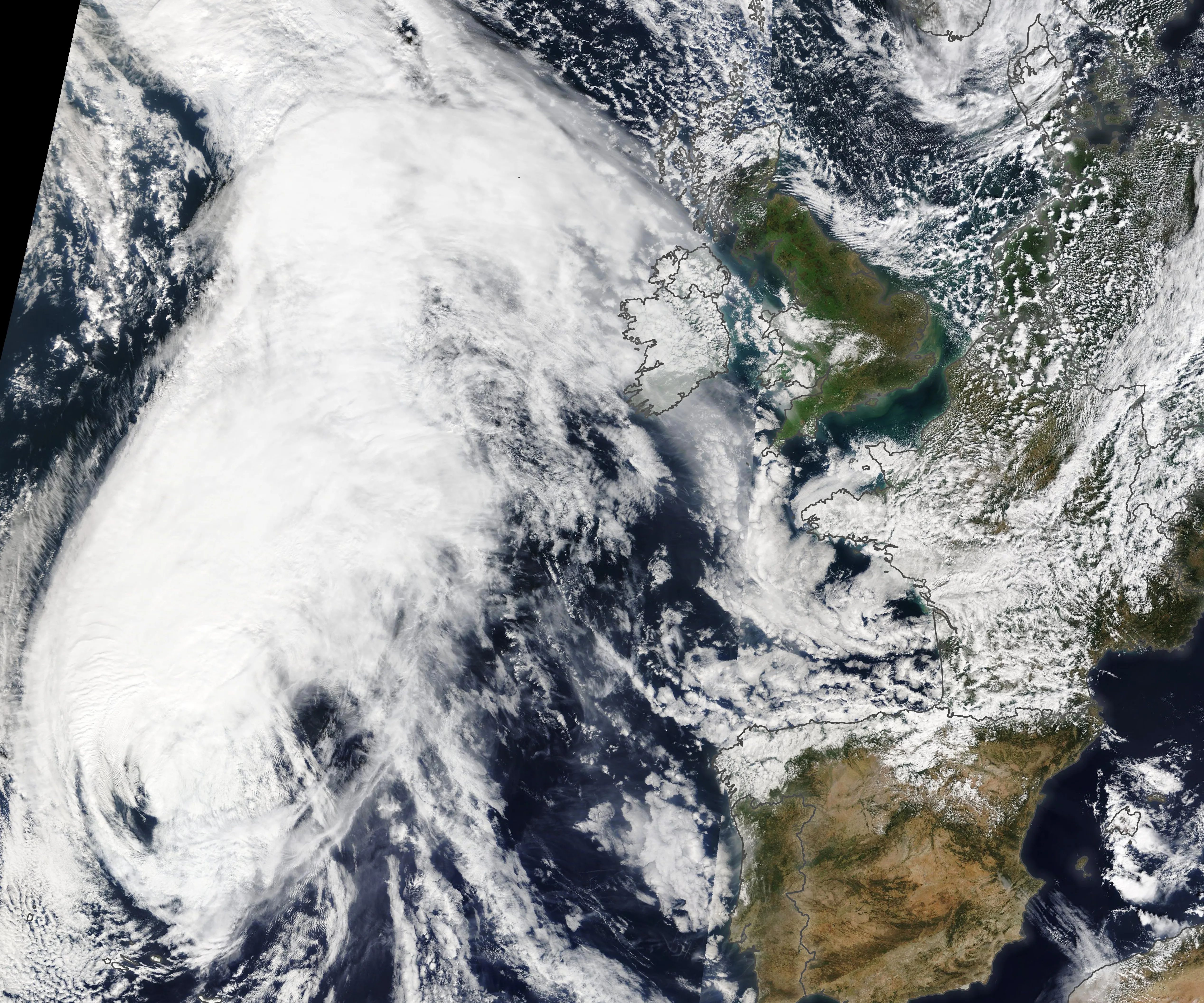
The Eyewall
Surrounding the eye is the eyewall, a ring of towering thunderstorms containing the hurricane's strongest winds and intense rain; the lowest surface pressure is normally in the eye.1 This is where warm, moist air rising from the sea surface releases the latent heat that drives the entire system, and the fastest winds occur near its inner edge, at the radius of maximum winds. In very intense storms a second eyewall can form outside the first, separated by a relatively rain-free ring called the moat, during an eyewall replacement cycle.2
Rainbands
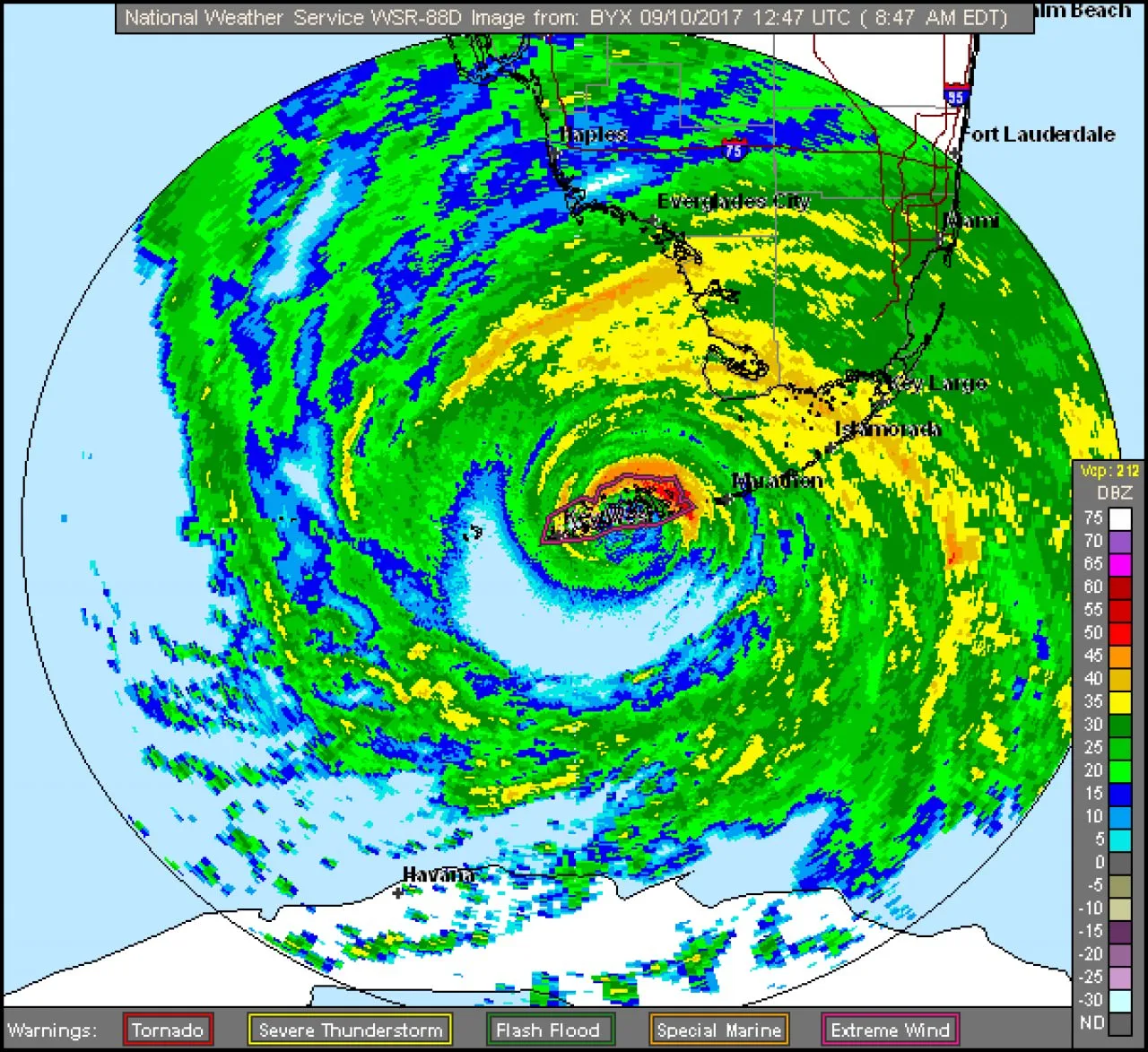
Spiraling outward from the eyewall are the rainbands: long, curved bands of showers and thunderstorms that can stretch for hundreds of kilometers from the center.3 They deliver episodic heavy rain and gusty winds well around and ahead of the core, and they can spawn tornadoes, especially in the storm's right-front quadrant at landfall. Because rainbands reach so far, a hurricane's hazards are felt across a much wider area than the eyewall alone.
The Wind Field and Its Asymmetry
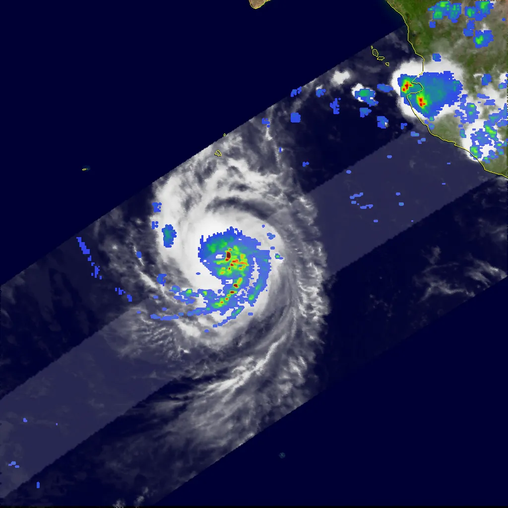
A hurricane's winds are not distributed evenly. In the Northern Hemisphere, the strongest winds and highest storm surge usually occur in the right-front quadrant relative to the storm's motion, because there the forward speed of the storm adds to its rotational winds.3 High above, an outflow layer exhausts air outward at the top of the storm; efficient outflow lets the surface circulation intensify, tying the storm's vertical structure to its strength.4
Storm motion can strengthen winds on one side, but the location of the highest surge also depends on onshore wind direction, storm size, track, coastal shape, and water depth. A right-front-quadrant rule cannot replace a local surge forecast.
Size: From Compact to Sprawling
Intensity and size are largely independent. A small but ferocious hurricane may pack Category 5 winds into a core only tens of kilometers wide, while a weaker storm can spread tropical-storm-force winds across many hundreds of kilometers.3 Hurricane Sandy (2012) was an extreme example of the latter, with a wind field more than 1,000 miles (1,600 kilometers) across.
Size deserves as much attention as category, and usually gets far less. A broad Category 2 can drive a higher surge than a compact Category 4, because a larger wind field pushes more water ashore and batters a longer stretch of coast for longer. Size and structure are also harder to observe and forecast than peak wind, which is part of why surge and wind forecasts for a specific location carry more uncertainty than the headline category implies.
Sources
-
National Hurricane Center. Glossary of NHC Terms. NOAA. https://www.nhc.noaa.gov/aboutgloss.shtml ↩ ↩2
-
Willoughby, H. E., Clos, J. A., & Shoreibah, M. G. (1982). Concentric eyewalls, secondary wind maxima, and the evolution of the hurricane vortex. Journal of the Atmospheric Sciences, 39(2), 395–411. https://doi.org/10.1175/1520-0469(1982)039%3C0395:CEWSWM%3E2.0.CO;2 ↩
-
Hurricane Research Division. Frequently Asked Questions. NOAA Atlantic Oceanographic and Meteorological Laboratory. https://www.aoml.noaa.gov/hrd-faq/ ↩ ↩2 ↩3
-
Emanuel, K. (2005). Divine Wind: The History and Science of Hurricanes. Oxford University Press. https://academic.oup.com/book/54547 ↩