How do we know a hurricane is coming days before it shows up? It takes a whole team: pilots, scientists, satellites, and supercomputers, all working around the clock. Some people fly airplanes right through the middle of a hurricane. Others watch it from space. And back on the ground, computers do billions of math problems to guess where the storm goes next. Let's meet them.
The Hurricane Hunters
Believe it or not, some people fly airplanes straight into hurricanes on purpose. They're called Hurricane Hunters, and they're some of the bravest crews you'll ever hear about. Two main teams take on the job.
The Air Force Hurricane Hunters
The 53rd Weather Reconnaissance Squadron is part of the U.S. Air Force Reserve, based at Keesler Air Force Base in Biloxi, Mississippi. These crews fly the WC-130J Super Hercules, a big, tough, four-engine plane built to handle wild turbulence. The Air Force Hurricane Hunters have been flying into storms since 1944. That makes them one of the longest-running weather missions ever.1
But the very first flight into a hurricane on purpose came even earlier. On July 27, 1943, Lieutenant Colonel Joseph Duckworth flew a small single-engine AT-6 Texan trainer into a hurricane near Galveston, Texas. People thought he was out of his mind. Instead, he proved a plane could survive inside a hurricane and bring back real data. That one flight changed weather science forever.
NOAA's Hurricane Hunters
The National Oceanic and Atmospheric Administration (NOAA) flies into hurricanes too. Its crews use P-3 Orion turboprop planes and a Gulfstream IV-SP jet. The P-3 Orions punch through the storm itself. The Gulfstream jet flies high around the outside, studying the air all around the hurricane.
What Happens on a Mission?
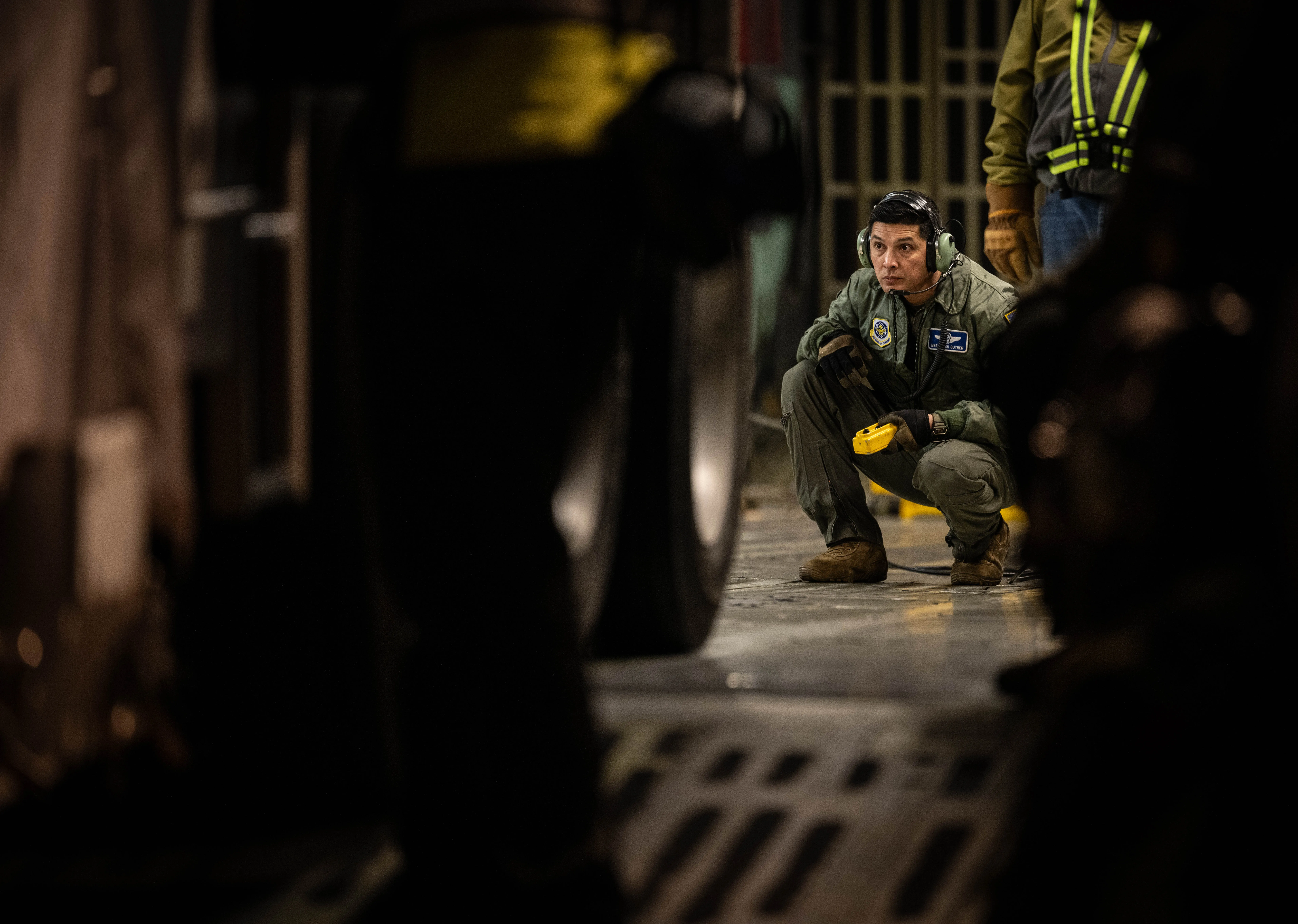
A Hurricane Hunter mission lasts about 10 hours. In that time, the crew flies through the eyewall, the ring of the fiercest thunderstorms around the calm eye, again and again. The ride is rough. Picture the wildest roller coaster you've ever been on, then multiply it by ten. Everyone straps in tight and holds on.
One of their biggest jobs is dropping dropsondes. A dropsonde is a little instrument tube, about the size of a paper towel roll, that floats down on a tiny parachute. As it falls through the storm, it measures temperature, humidity, air pressure, and wind, and radios it all back to the plane. Forecasters at the National Hurricane Center need that data to tell how strong the storm is and to sharpen their computer models.2 Dropsondes complement radar, satellites and other instruments.
Satellites in Space
Way up above Earth, weather satellites keep a constant eye on the sky. They're like giant cameras in space, and they're the best way to track a hurricane out over the open ocean, where planes and ships can't easily reach.
Satellites That Hover in One Spot
NOAA runs a set of satellites called GOES, short for Geostationary Operational Environmental Satellites. The two main ones right now are GOES-19 (also called GOES-East) and GOES-18 (GOES-West). They orbit 22,236 miles (35,786 km) above Earth.3 Way up there, they complete one orbit in the time Earth takes to turn once, so they stay parked over the same spot all the time. That's what "geostationary" means: it stays still compared to the ground.
Because they hover over one place, GOES satellites can snap a picture of the same area every 1 to 10 minutes.3 So scientists get to watch a hurricane grow and move almost like a movie. These satellites see cloud patterns, measure how cold the cloud tops are, and even estimate wind speeds.
Satellites That Circle the Earth
Another kind of weather satellite flies much lower. Polar-orbiting satellites, like NOAA-20 and the ones in the JPSS (Joint Polar Satellite System) program, orbit about 512 miles (824 km) up. Instead of parking in one spot, they loop the Earth from pole to pole and pass over each place about twice a day. Because they're so much closer, they can see finer details than the high satellites can.
How It All Started
TIROS-1 launched on April 1, 1960, beginning weather-satellite observations. Aircraft, ships and coastal stations already supplied storm information. Satellites greatly improved coverage, but instruments and storm identification still have limits.
Ocean Buoys and Underwater Sensors
Hurricanes run on warm ocean water, so keeping tabs on the ocean is a huge part of hurricane science. Scientists use a fleet of floating instruments to watch the sea day and night.
Weather Buoys
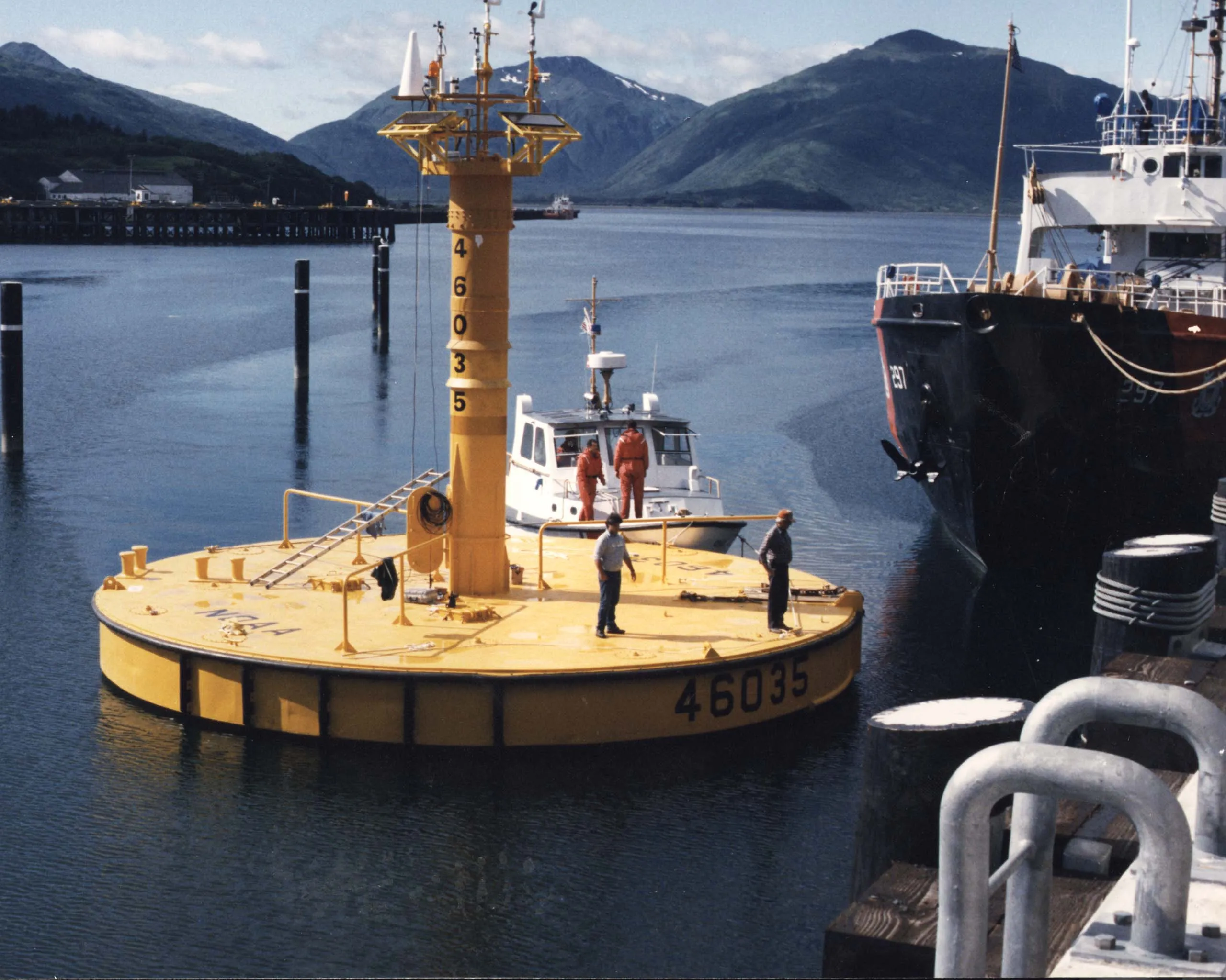
NOAA keeps a network of weather buoys across the Atlantic Ocean and the Gulf of Mexico. Each one is a floating weather station. It measures sea temperature, wave height, air pressure, and wind, then beams that up to a satellite, which passes it to forecasters on land. Some buoys are moored, anchored to the ocean floor so they stay put. Others drift freely with the currents, taking readings wherever the water carries them.
Argo Floats
One of the coolest ocean tools is the Argo float. Thousands of these robot floats are spread across the world's oceans. A typical core Argo float drifts near 1,000 m, then profiles from about 2,000 m to the surface on a roughly 10-day cycle. At the surface it sends observations by satellite. Then it dives again, over and over, for years.
Deep warm water can help a hurricane maintain strength. Scientists study water below the surface as well as the top layer. Ocean temperature is one clue; wind shear and other conditions matter too.
The National Hurricane Center
All the data, from the Hurricane Hunters, satellites, buoys, and more, flows into one very important place: the National Hurricane Center, or NHC. It sits in Miami, Florida, on the campus of Florida International University.
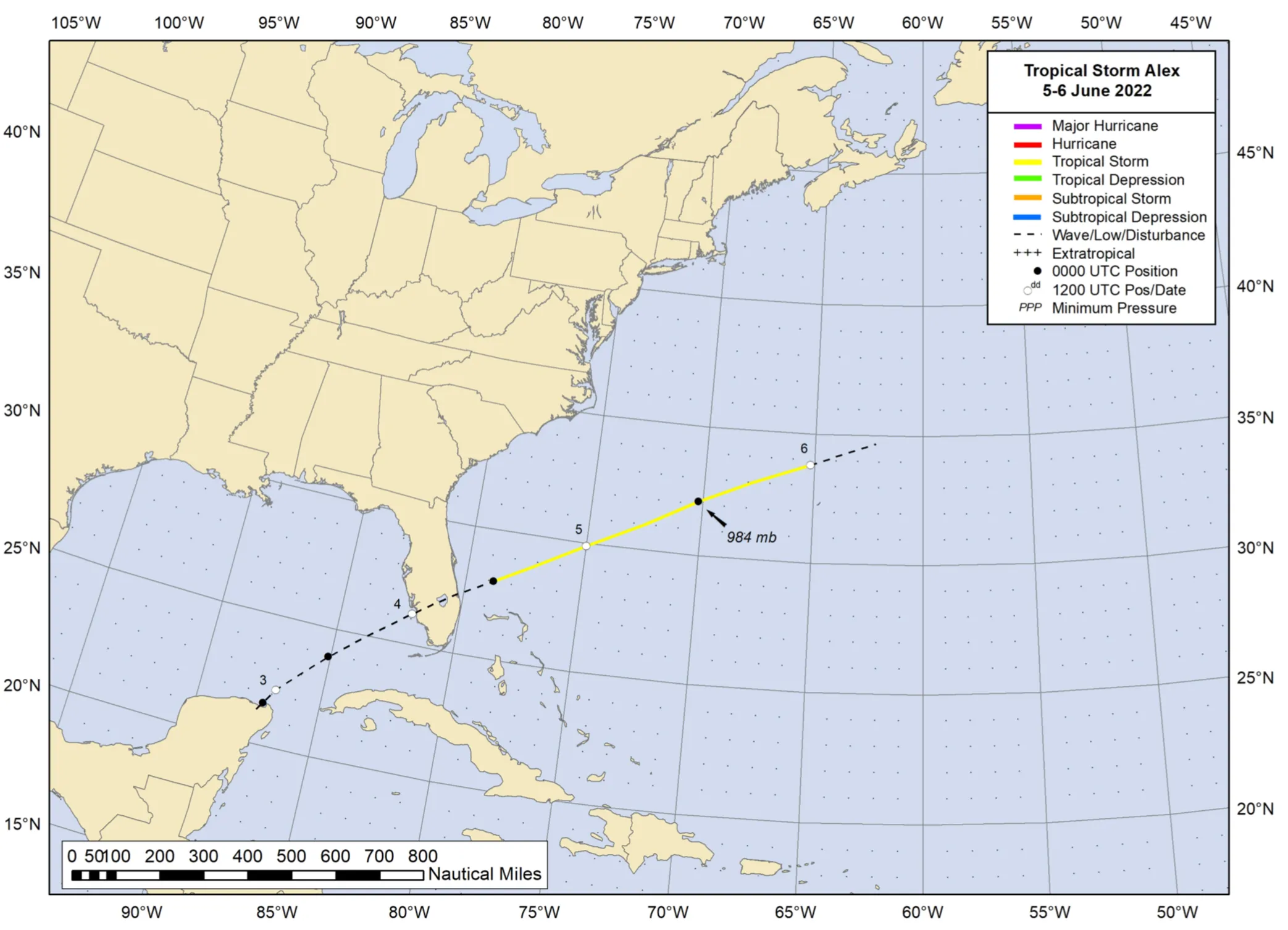
The NHC is part of NOAA's National Weather Service. During hurricane season, June 1 through November 30, it runs 24 hours a day, 7 days a week. The hurricane specialists there are some of the most experienced weather scientists in the world. Their job is to take all the satellite images, radar, plane reports, buoy readings, and computer models, and turn them into one official forecast.
Forecasts, Watches, and Warnings
NHC forecasts Atlantic and eastern North Pacific tropical cyclones. For U.S. hurricane watches and warnings, the familiar 48- and 36-hour lead times are measured before the expected arrival of tropical-storm-force winds, so preparations can finish before those winds make outdoor work dangerous.4
The Forecast Cone
You've probably seen the "forecast cone" on TV during a storm. Some people call it the "cone of uncertainty." It shows where the center of the hurricane will probably go over the next five days. The cone starts narrow and gets wider, because the further ahead you try to guess, the less sure the forecast is.
The forecast cone shows where the storm’s center may travel. Wind, rain, and storm surge can affect places outside it. Read the warnings with a trusted adult and follow local instructions.
Computer Models and Forecasting
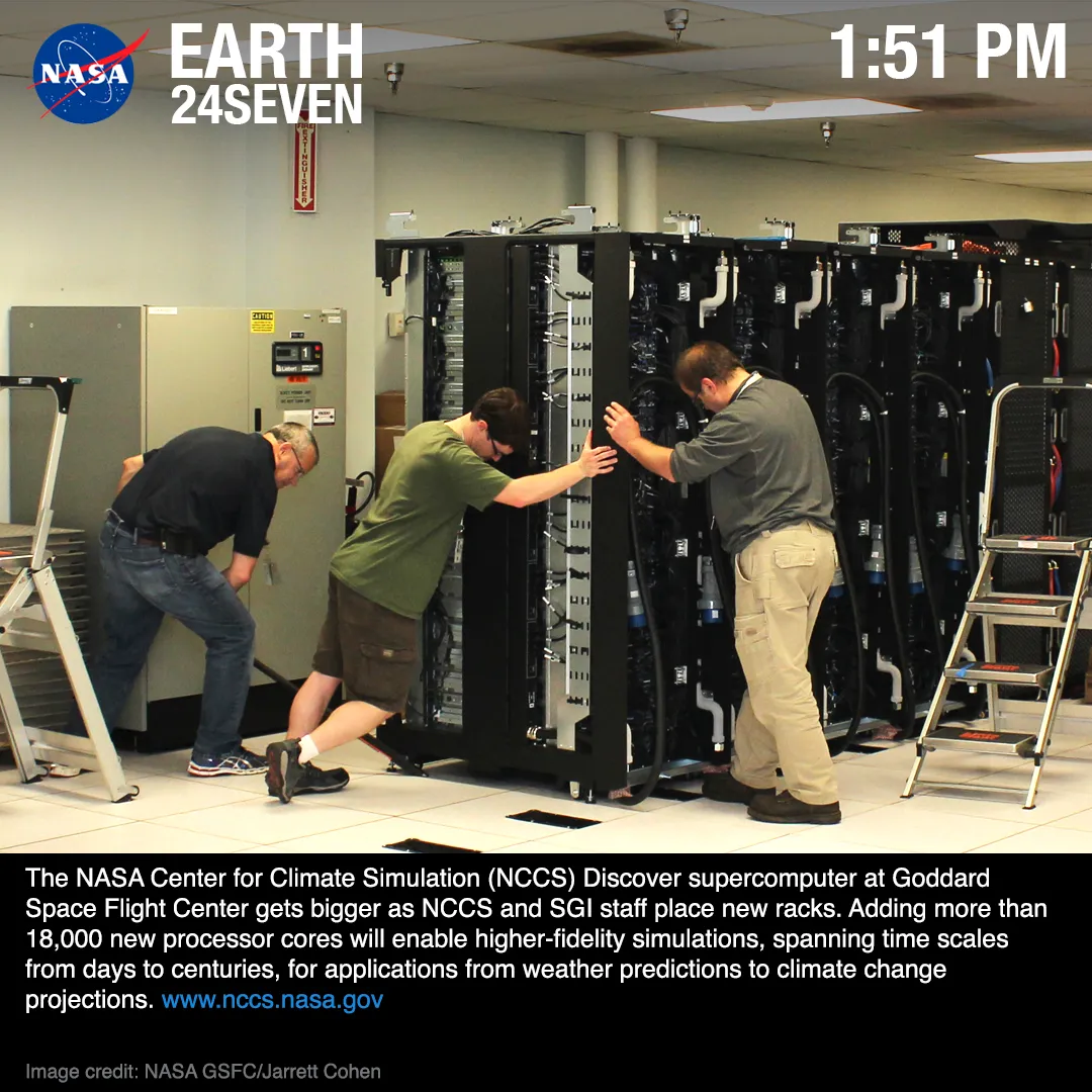
Modern hurricane forecasting leans hard on powerful computers. Scientists run big programs called numerical weather prediction models. These programs use math and physics to act out how the air will move in the days ahead.
The Big Hurricane Models
Examples include NOAA’s GFS, ECMWF’s Integrated Forecasting System and NOAA’s Hurricane Analysis and Forecast System (HAFS). ECMWF is an organization, not the name of a single model. Different models serve different forecasting needs.
How Models Work
These models chop the whole atmosphere into millions of tiny 3-D boxes. For each box, the computer works out the temperature, pressure, humidity, and wind, then figures out what happens a few seconds later. It repeats that step again and again, marching forward in time, until it's built a forecast several days out. It takes staggering computing power. The fastest weather computers do quadrillions of calculations every second.
Why Models Sometimes Disagree
Watch hurricane coverage and you might hear about "spaghetti models," maps that show the predicted paths from many models at once. The lines really do look like noodles on a plate. Different models sometimes disagree about where a storm will go or how strong it'll get. Forecasters use their training and experience to judge which models are doing best for that storm, then make the official call.
Forecasts Are Getting Better
NHC verification shows that forecasts have improved over the long term. The size of an improvement depends on which basin, forecast length and years are compared.2
There is still a hard part. Guessing how strong a hurricane will get is still much tougher than guessing where it will go. A storm can blow up in strength in a single day, and that jump is the thing forecasters lose the most sleep over. Predicting these sudden changes remains an active area of research.
Hurricane Science Careers
If hurricane science sounds exciting to you, you're right. Lots of different careers study these storms and keep people safe. Here are a few.
- Meteorologist: a scientist who studies weather and the atmosphere. It takes a college degree in meteorology or atmospheric science. They work at weather offices, TV stations, and research labs.
- Hurricane Specialist: the expert forecasters at the National Hurricane Center. It takes years of forecasting experience and a deep grasp of tropical weather.
- Hurricane Hunter Flight Crew: the pilots, navigators, weather officers, and loadmasters who fly into storms. They need special military or aviation training, and nerves for heavy turbulence.
- Research Scientist: these scientists study how hurricanes work, hunt for patterns in the data, and build better forecasting methods. Many work at universities or government labs.
- Emergency Manager: they use the forecasts to protect towns, planning evacuations, opening shelters, and organizing help before, during, and after a storm.
- Broadcast Meteorologist: the forecasters you see on TV or follow online. Their job is to explain the weather so clearly that everyone understands it and stays safe.
Love science, math, or helping people? There might be a hurricane career waiting for you. The work these people do gives families the warning time that keeps them safe.
From Watching Storms to Making One
All these tools, the planes, the satellites, the buoys, the supercomputers, add up to one thing: warning time. A hurricane you can see coming is a hurricane you can prepare for.
Now that you know how the pros study a storm, try being the scientist yourself. Head to Make Your Own Hurricane for experiments you can do at home, or go back to the basics with What Is a Hurricane?.
Sources
-
53rd Weather Reconnaissance Squadron. Hurricane Hunters Fact Sheet. U.S. Air Force Reserve Command. https://www.403wg.afrc.af.mil/About-Us/Fact-Sheets/ ↩
-
NOAA National Hurricane Center. NHC Forecast Verification. https://www.nhc.noaa.gov/verification/ ↩ ↩2
-
NOAA Satellite and Information Service. GOES Overview. https://www.nesdis.noaa.gov/current-satellite-missions/currently-flying/goes ↩ ↩2
-
NHC glossary. https://www.nhc.noaa.gov/aboutgloss.shtml ↩