Category 3 at Landfall

Hurricane Wilma

The most intense Atlantic hurricane ever recorded with a central pressure of 882 mb, Wilma rapidly transited South Florida in October 2005, devastating the region with extreme winds and knocking out power to 3.2 million residents.

Last updated July 3, 2026

Hurricane Wilma was the most intense Atlantic hurricane ever recorded, with a central pressure of 882 millibars. In October 2005, during the record-shattering 2005 season, it underwent the most extreme rapid intensification ever observed in the basin, devastated Mexico's Yucatán Peninsula, and then raced across South Florida, knocking out power to millions.
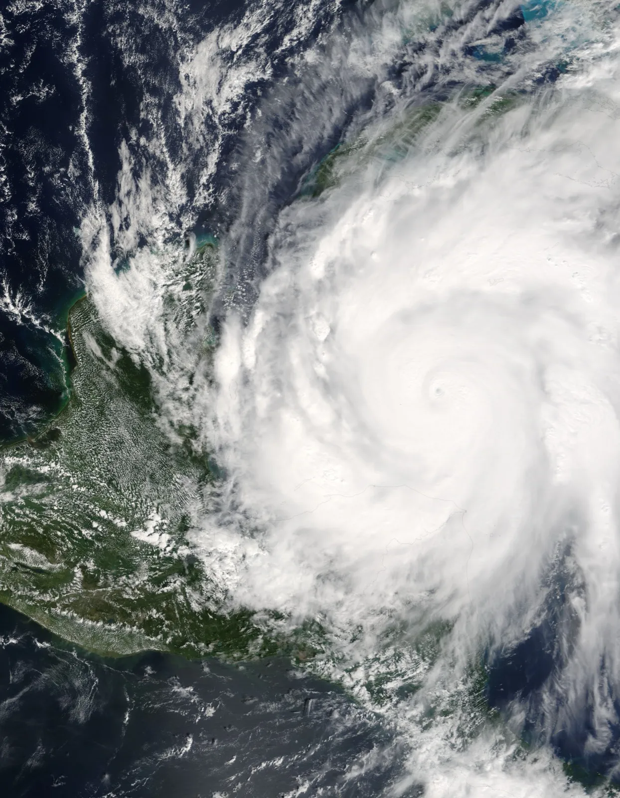
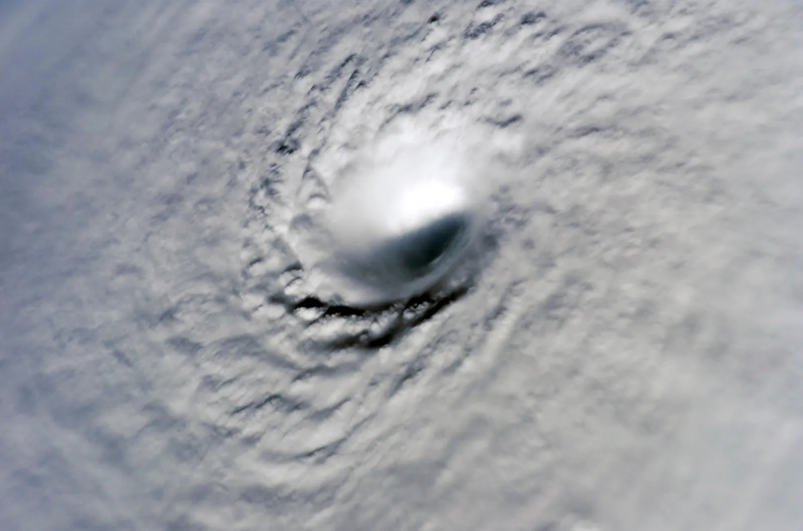
Satellite image of Hurricane Wilma at peak Category 5 intensity on October 19, 2005
Hurricane Wilma at peak intensity on October 19, 2005, when its central pressure fell to a record 882 mb. Credit: NASA · Public domain

Record-Breaking Intensification

Wilma formed in the Caribbean in mid-October 2005. On October 18–19 it intensified explosively, its central pressure plunging about 97 mb in 24 hours, the fastest deepening ever recorded in the Atlantic basin, to a record low of 882 mb, with peak sustained winds of 185 mph (300 km/h).1 At peak intensity Wilma's eye contracted to a pinhole only a few miles across, among the smallest ever observed.

The number that stops us is that intensification rate: about 97 mb of pressure fall in a single day. That is the fastest deepening ever measured in the Atlantic, and it happened over open water where it threatened no one, which is much of the reason Wilma is remembered as a record rather than a catastrophe. A storm that does what Wilma did in the 24 hours before a populated landfall, rather than far out in the Caribbean, is close to the worst case the forecasting system can face, and it is exactly the scenario that keeps us cautious about how much warning a coast can count on.

Wilma was already a record-setter for the 2005 season: its 21st named storm, breaking a mark that had stood since 1933 and forcing forecasters to begin using the Greek alphabet for later storms.1 Reconnaissance aircraft measured the 882 mb pressure and an eye that had contracted to roughly 2.3 miles (3.7 km) in diameter, the compact, ferocious core characteristic of a hurricane near its theoretical maximum intensity.1

View looking down into the tiny eye of Hurricane Wilma from the International Space Station
Looking down into Wilma's pinhole eye from the International Space Station: at peak the eye was only about 2.3 miles (3.7 km) across. Credit: NASA (ISS) · Public domain

Landfalls

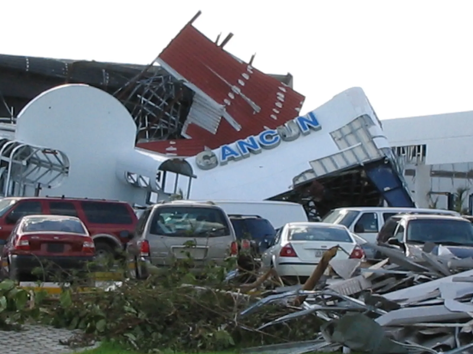
Wilma first struck the northeastern Yucatán Peninsula near Cozumel and Cancún on October 21–22 as a Category 4, where it nearly stalled and battered the resort coast for more than a day with destructive winds, surge, and rain.1 Parts of the Cancún–Cozumel corridor endured close to 50 hours of hurricane-force winds, gutting hotels, stripping beaches, and stranding thousands of tourists, making Wilma one of the most destructive storms on record for Mexico's Caribbean coast.1

A wrecked building in Cancun, Mexico after Hurricane Wilma
A building in Cancún wrecked by Wilma, which battered the Yucatán resort coast for close to 50 hours. Credit: eheçåtzin · CC BY 2.0

Wilma then accelerated northeast across the Gulf and made landfall in southwest Florida near Cape Romano on October 24 as a Category 3 with winds near 120 mph (195 km/h), crossing the peninsula in only about 4.5 hours.1

Florida Impacts

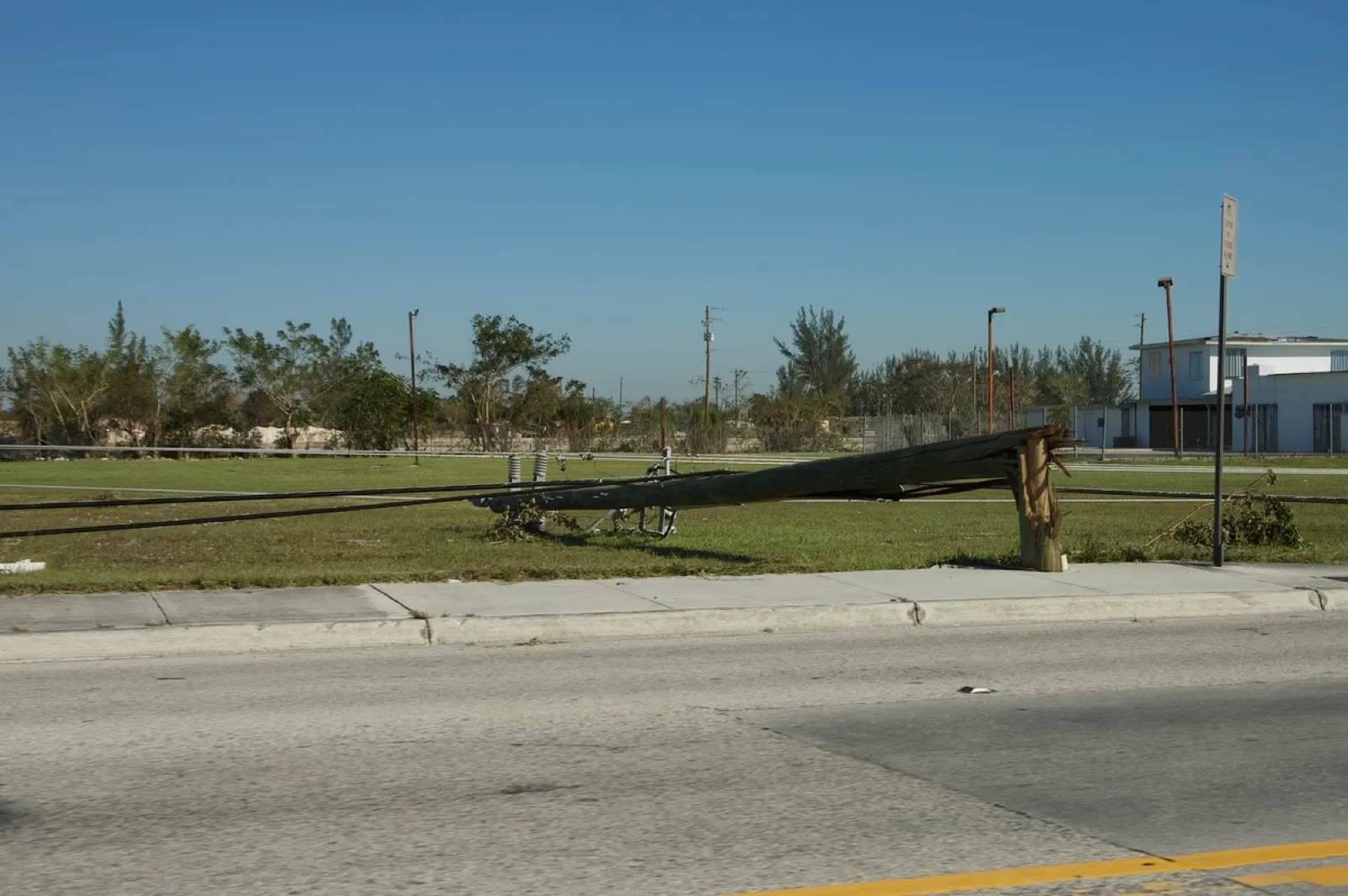
Despite its fast transit, Wilma caused extensive damage across South Florida. Its winds knocked out power to roughly 3.2 million customers, at the time one of the largest outages in Florida history, and damaged a large share of buildings across Miami-Dade, Broward, and Palm Beach counties.1 The outages spanned 42 counties, and in the Miami metropolitan area roughly 98% of customers lost service, some for weeks.1 Wind-borne debris shattered windows in downtown Miami high-rises and the storm inflicted heavy losses on South Florida's citrus and agriculture, a reminder that even a major hurricane crossing the peninsula in only about 4.5 hours can do enormous damage.

A snapped utility pole and downed power lines along a road in the Miami area after Hurricane Wilma
A snapped utility pole near Miami: Wilma knocked out power to more than 3.2 million customers across South Florida. Credit: K7HPN · CC0

Wilma caused 52 deaths and about $26.5 billion in damage in 2005, roughly $30 billion adjusted to 2024.2

Legacy

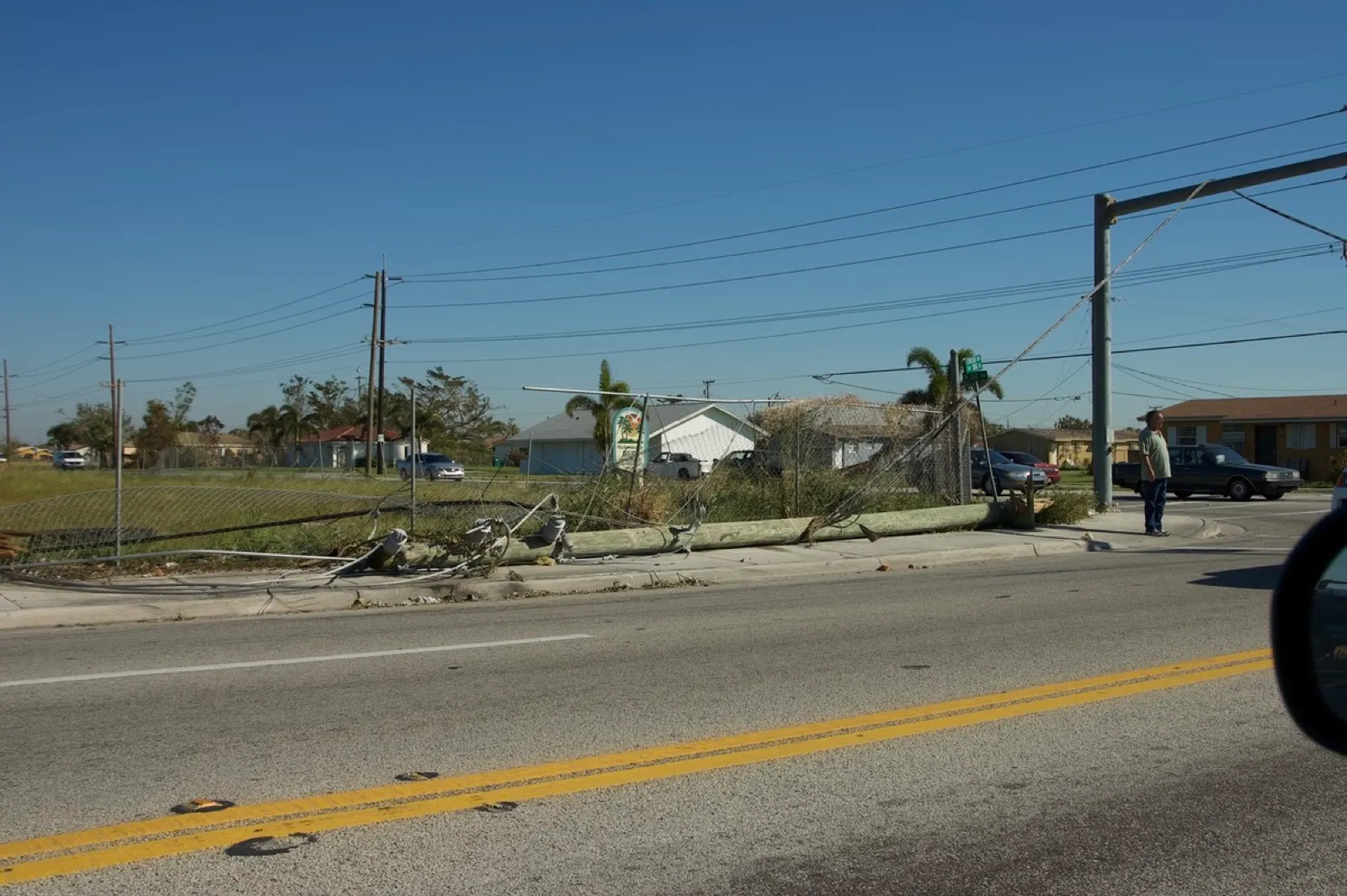
Wilma closed out the most active Atlantic hurricane season on record, and its 882 mb pressure remains the lowest ever measured in the Atlantic, surpassed in the Western Hemisphere only by the eastern Pacific's Hurricane Patricia (2015). For Florida, Wilma began a record 11-year "hurricane drought": no hurricane struck the state again until Hermine in 2016. Its prolonged, widespread outages also reshaped utility hardening and emergency planning across the region. The hardening that followed is the kind of unglamorous, expensive work that rarely makes headlines but quietly decides how long the lights stay off after the next storm. For the record season Wilma capped, see hurricane season trends.

Downed power lines along a suburban road in the Miami area after Hurricane Wilma
Downed lines in suburban Miami: restoring power across 42 counties took weeks and spurred lasting utility-hardening efforts. Credit: K7HPN · CC0

Sources

  1. Pasch, R. J., Blake, E. S., Cobb, H. D., & Roberts, D. P. (2006). Tropical Cyclone Report: Hurricane Wilma (AL252005). National Hurricane Center. https://www.nhc.noaa.gov/data/tcr/AL252005_Wilma.pdf 2 3 4 5 6 7 8

  2. NOAA National Centers for Environmental Information. U.S. Billion-Dollar Weather and Climate Disasters. https://www.ncei.noaa.gov/access/billions/

Continue Reading